Prelude
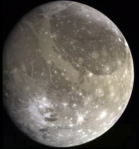
Students at all levels in geology can learn to read, interpret, and construct geologic maps to better describe and understande the geology around us. The combination of geologic information with topographic maps can be a very powerful and useful tool to describe and interpret not only the Earth, but other hard-surfaced planetary bodies, too (see Figure 3-1). Geologic maps portray the location, distribution, and age of many kinds of natural features, like rock units, mountains, faults, folds, mineral deposits, etc. They may also include information about subsurface features. Data from these maps are important in many types of human activity, like land-use planning, hazard assessment (earthquakes, volcanoes, flooding), etc. They are important in planetary studies because they show the similarities and differences between geologic processes that occur on Earth and its planterary neighbors. Data can also be collected remotely, like from an orbiting satellite or automated rover. This is how we have mapped the geology of most of the Moon and several other planetary bodies.
|
|
|
|
Figure 3-1. Geology isn't only for Earth. Ganymede (left) is Jupiter's largest moon, and the largest natural satellite in our Solar System. Remember to click on the highlighted images to see larger versions. |
|
What Will You Do Today?
|
|
Read and interpret geologic maps and cross sections that describe the geology of the world around us |
A. Reading Geologic Maps - Practice the basics of reading and interpreting geologic maps
B. Earth Geologic Map - Learn about Earth geology by reading the Geologic Map of Arizona
C. Geology of Another Planet - Learn about Mars geology by reading the Geologic Map of the Tharsis Quadrangle
D. Dating a Planetary Surface - Use common sense observations to determine the relative ages of various geologic features on a planetary surface