Prelude
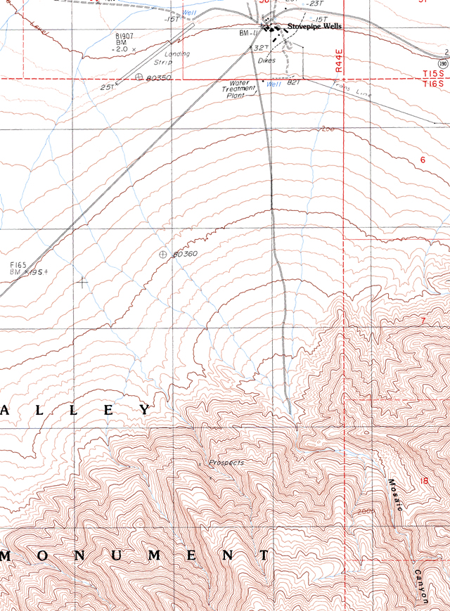
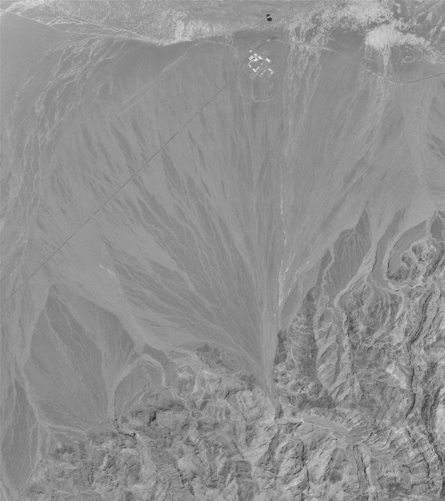
The scenery we see forms as a result of many different geologic processes (like sedimentation, volcanic eruptions, weathering, erosion, uplift, etc.). Ultimately, understanding the landscapes helps to increase our knowledge of these geologic processes. Landscapes on Earth (or on other planets) can be represented by various media, including: ground, aerial, and satellite pictures, two-dimensional (2D) contour (topographic) maps and profiles, three-dimensional (3D) models, etc. Examples of some of these media are shown in Figure 2-1 for a part of Death Valley, California. You will learn to interpret some of these media in this lab, which will serve as a foundation for subsequent activities about the importance of landscapes in geologic studies.
|
|
|
|
Figure 2-1. Reading and interpreting maps with elevation contours (topographic maps) is critical to understanding landscapes.A topographic map (left) and aerial photo (right) of the Stovepipe Wells area. Remember to click on the highlighted images to see larger versions. |
|
What Will You Do Today?
|
|
Read and interpret different types of images and maps that can be used to describe a planetary landscape |
A. Reading Topographic Maps - Review some of the important aspects of how to read and interpret topographic maps
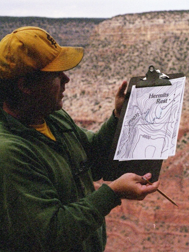
B. Topographic Map of the Cape Royal Quadrangle - Practice your map reading skills using this map from the Grand Canyon
C. Mars Exploration Rover Landing Sites - Look at where the exploration rovers, Spirit and Opportunity, landed on Mars
D. Getting Oriented - Relate features on a landscape model to a topographic map