Part D
Geology of the San Francisco Mountain Area
Quaternary volcanic rocks are important components to many terranes around the world, and are displayed on many different geologic maps. This is certainly the case in Arizona, where several areas of the state witnessed volcanic eruptions during the Quaternary. The Flagstaff area is home to the San Francisco volcanic field (SFVF), with over 600 individual volcanic vents and many outstanding examples of different volcano types. To learn more about the main feature in the SFVF, let's look at the geology of the San Francisco Mountain area by reviewing the Geologic Map of San Francisco Mountain, Elden Mountain, and the Dry Lake Hills, Coconino County, Arizona. San Francisco Mountain is the main landform on the map and is crowned by several peaks, including Doyle, Fremont, Agassiz, Humphreys (the highest point in Arizona), Aubineau, and Reese.
|
Figure 15-9. A panorama of Elden Mountain, San Francisco Mountain, and Sugarloaf Mountain as viewed from the east. |
Geologic Map of San Francisco Mountain, Elden Mountain, and the Dry Lake Hills
|
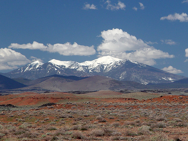
Figure 15-10. San Francisco Mountain and its San Francisco Peaks. As viewed from the Grand Falls area to the northeast, Humphreys Peak is the highest snow-capped summit in the background (left). |
|
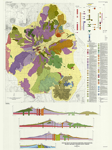
Answer Quiz Me! questions D30 through D48 using the Geologic Map of San Francisco Mountain, Elden Mountain, and the Dry Lake Hills (see the PDF link below). The questions refer to the geologic map, Description of Map Units, Correlation of Map Units, and cross section. If necessary, refer to your rock identification charts (Igneous HERE / Metamorphic HERE / Sedimentary HERE) and the Volcano Review Table (see PDF HERE).
|
Geologic Map of San Francisco Mountain, Elden Mountain, and the Dry Lake Hills |
|
Dacite is a felsic volcanic rock, intermediate in composition between andesite and rhyolite. |
Fern Mountain & Hart Prairie
Fern Mountain and Hart Prairie are located near the west edge of the map near 35° 20'N, 111° 44' W.
![]()
![]()
![]()
Elden Mountain
Elden Mountain is located in the southeast part of the map at 35° 15' N, 111° 36' 30" W
![]()
![]()
![]()
![]()
Sugarloaf Mountain
Sugarloaf Mountain is located in the northeast part of the map at the northeast end of the Interior Valley near 35° 22'N, 111° 37' W.
![]()
![]()
![]()
![]()
San Francisco Mountain
San Francisco Mountain is the main topographic feature on the map and is crowned by several peaks, including Doyle, Fremont, Agassiz, Humphreys, Aubineau, and Reese. Humphreys Peak, the highest point in Arizona, is located near the center of the map around 35° 21'N, 111° 41' W.
![]()
![]()
![]()
![]()
![]()
![]()
![]()
![]()
Geology of San Francisco Mountain
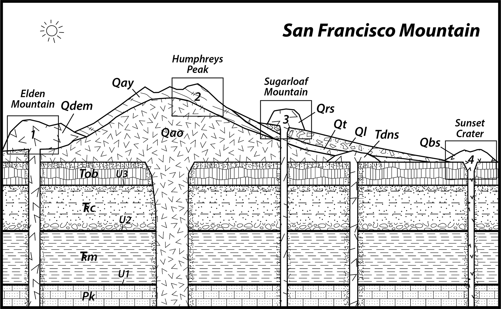
Let's look more closely at a geologic cross section of the San Francisco Mountain area, located in the heart of the San Francisco volcanic field of northern Arizona.
|
Figure 15-11. A sequence diagram for the San Francisco Mountain area. Click HERE for a printable PDF version. |
Answer Quiz Me! questions D49 and D50 using the San Francisco Mountain sequence diagram (Figure 15-11). Print a hard-copy of the diagram if necessary (see the link below for a printable PDF version). Also refer to the Key to Map Fill Patterns (see PDF HERE) and your rock identification charts.
![]()
![]()
After finishing this lesson, complete the form below:


