Part D
Laramide Geology
The Late Cretaceous to Early Paleogene Laramide Orogeny produced different styles of compressional deformation across the North American Cordillera. Fold-and-thrust style structures formed in the Northern Rockies (Wyoming, Montana, Idaho) and Canadian Rockies, as well as in the Sierra Madre region to the south. Large, basement-cored uplifts along high-angle reverse faults formed the southern Rockies (Colorado and New Mexico). In the Colorado Plateau region of southern Utah and northern Arizona, Paleozoic and Mesozoic sedimentary layers were deformed into monoclinal folds that formed above deeper high-angle reverse faults. These are "textbook" examples of monocline folds and include numerous, well-exposed examples from the eastern Grand Canyon area east into New Mexico and north into Utah and even Colorado.
|
|
|
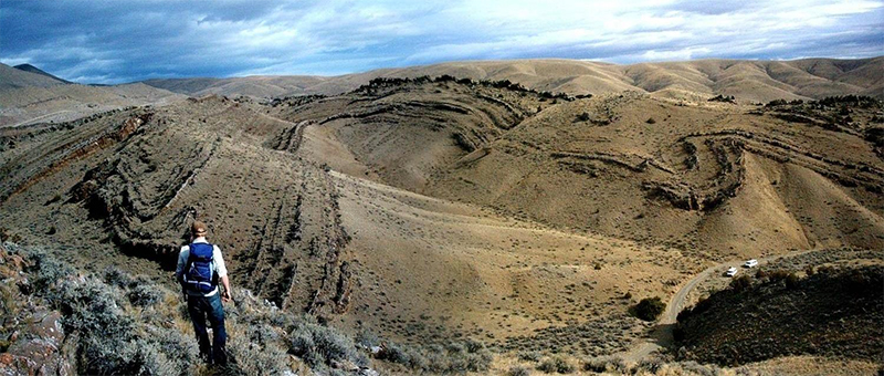
Figure 13-9. Folded Cretaceous rocks in southwestern Montana represent typical Laramide geology of the northern Rocky Mountains. |
Geology of the Northern Rocky Mountains
The geology of the northern Rocky Mountains in Wyoming is complex, but some of it represents the Late Cretaceous - Early Paleogene Laramide Orogeny. Geologic structures representing this tectonic event are exposed in the Sheep Creek area of Montana, located along the Missouri River between Helena and Great Falls.
|
|
|
|
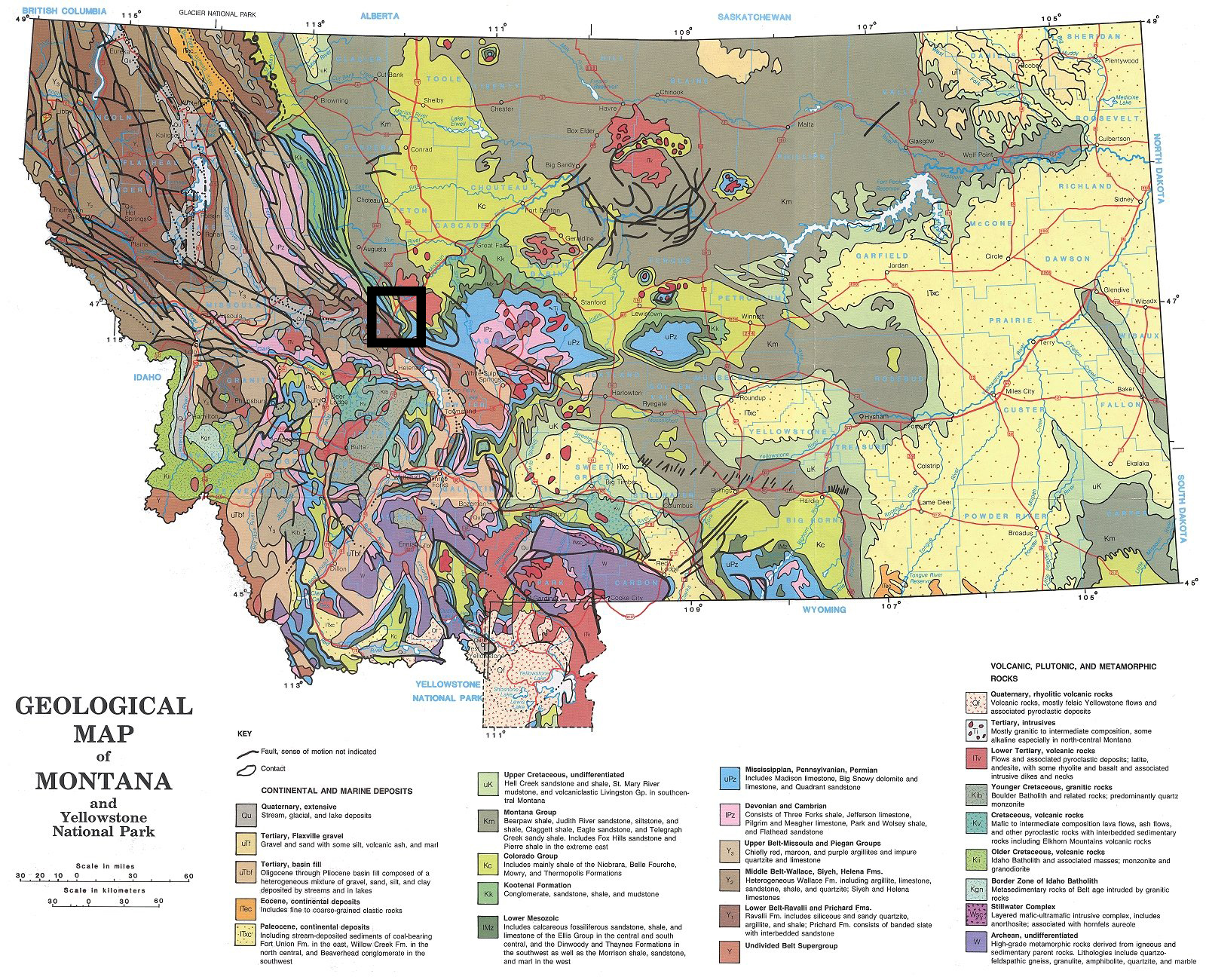
Figure 13-10. The geology of the northern Rocky Mountains is well represented in Montana. At left, the geologic map of Montana with the location of the Sheep Creek quadrangle shown by the box. |
|
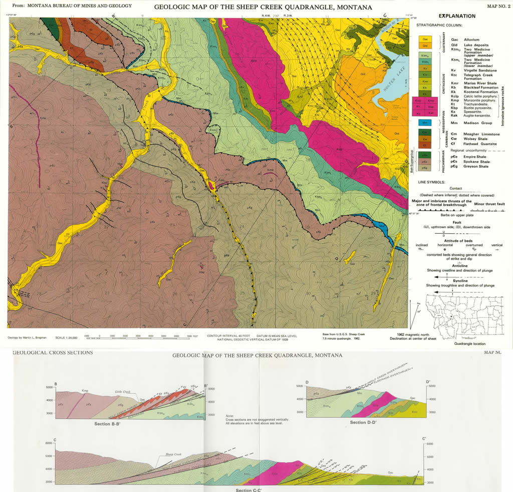
Answer Quiz Me! questions D26 through C34 using the Geologic Map of the Sheep Creek Quadrangle, Montana (see the PDF links below). If necessary, refer to your rock identification charts (Igneous HERE / Metamorphic HERE / Sedimentary HERE).
|
Geologic Map of the Sheep Creek Quadrangle, Montana |
|
Geologic Map of the Sheep Creek Quadrangle, Montana - cross sections |
Explanation
Geologic Map
Cross Sections
Geology of the Coconino Point & Grandview Point Quadrangles
The Colorado Plateau area east and southeast of the Grand Canyon includes a number of areas with well exposed Laramide monoclines. Located just south of the Little Colorado River gorge, Gray Mountain is one such area. Here, deep-seated basement-cored uplifts warped and even faulted the overlying Paleozoic and Mesozoic sedimentary strata.
|
|
|
|
Figure 13-11. Northern Arizona is world-famous for its monoclines! At left, several monoclines are present on the Geologic Map of Coconino Point and Grandview quadrangles. |
|
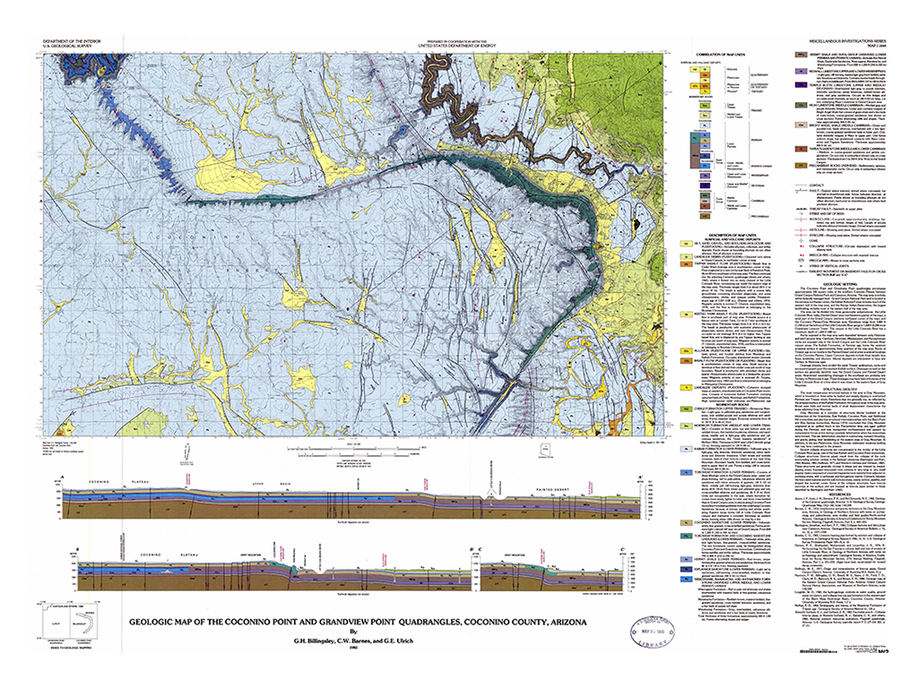
Answer Quiz Me! questions D35 through D45 using the Geologic Map of the Coconino Point & Grandview Point Quadrangles, Coconino County, Arizona (see the PDF link below). If necessary, refer to your rock identification charts (Igneous HERE / Metamorphic HERE / Sedimentary HERE).
|
Geologic Map of the Coconino Point & Grandview Point Quadrangles, Coconino County, Arizona |
Description of Map Units and Symbols
Geologic Map
Cross Section B-B'
Monoclines of the Gray Mountain Area
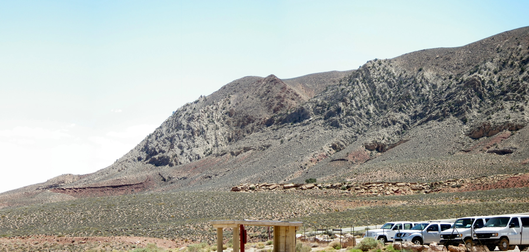
Traveling north on US 89A from Flagstaff, one leaves the volcanic-dominated landscape of the San Francisco volcanic field and enters the sedimentary landscape of the Painted Desert. At the community of Cameron, highway AZ 64 leads to the west toward the eastern entrance to the Grand Canyon near Desert View. Several monoclines are exposed in this area, including the one that forms Gray Mountain, which looms on the south side of the highway (see Figure 13-12). Let's take a closer look at the geology of this area.
|
|
|
|
|
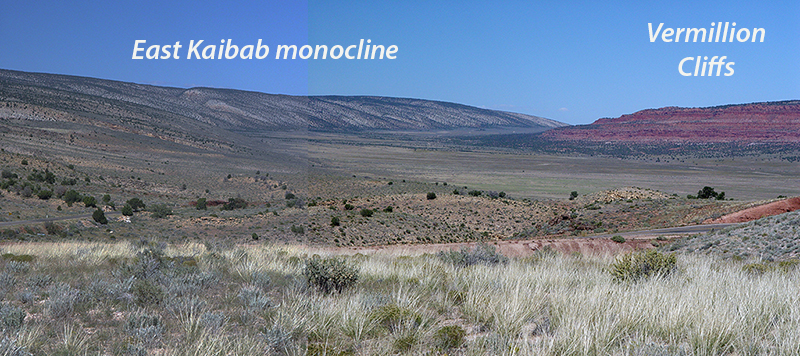
Figure 13-12. Northern Arizona is world-famous for its monoclines! The Kaibab Plateau - Vermillion Cliffs area of the East Kaibab Monocline (top). |
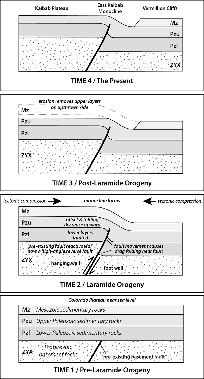
Now, let's look a simplified sequence diagram for the Gray Mountain area (see Figure 13-13).
|
|
|
Figure 13-13. The Gray Mountain sequence diagram. Unit explanation: Kaibab Formation (Pk), Moenkopi Formation (Trm), Shadow Mountain basaltic volcanics (Qv), Pennsylvanian-Permian rocks, undivided (PPu), Shinarump Conglomerate member of the Chinle Formation (Trc), Toroweap Formation and Coconino Sandstone (Ptc). Note: Trc is drag-folded by fault X. Qv represents a post-tectonic eruption. Click HERE for a printable PDF version. |
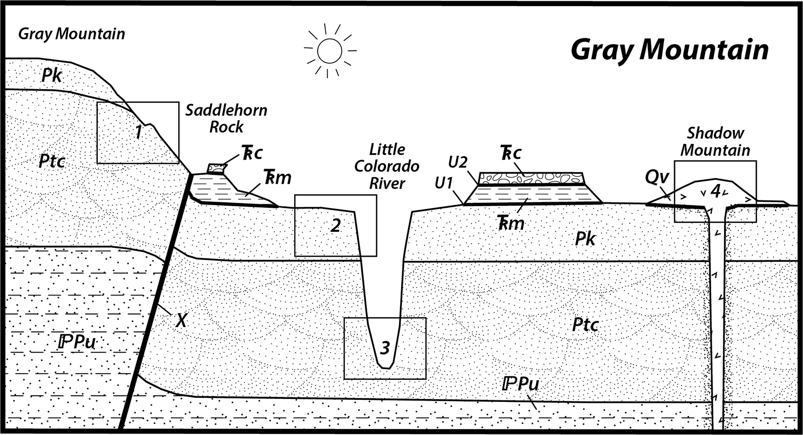
Answer Quiz Me! questions D46 through D50 using Gray Mountain sequence diagram (Figure 13-13). Print a hard-copy of the diagram if necessary (see the link above for a printable PDF version). Also refer to the Key to Map Fill Patterns (see PDF HERE) and your rock identification charts.
After finishing this lesson, complete the form below: