Part B
Cretaceous Geology & Life Forms
The Cretaceous Period was a dynamic interval in Earth's history. Tectonic plate interactions created diverse geographies that included tectonic and volcanic mountain ranges, opening and closing ocean basins, and vast inland seaways. Plant and animal life flourished during this time, with reptiles dominating the land sea, and air and flowering plants becoming abundant.
|
|
|
|
|
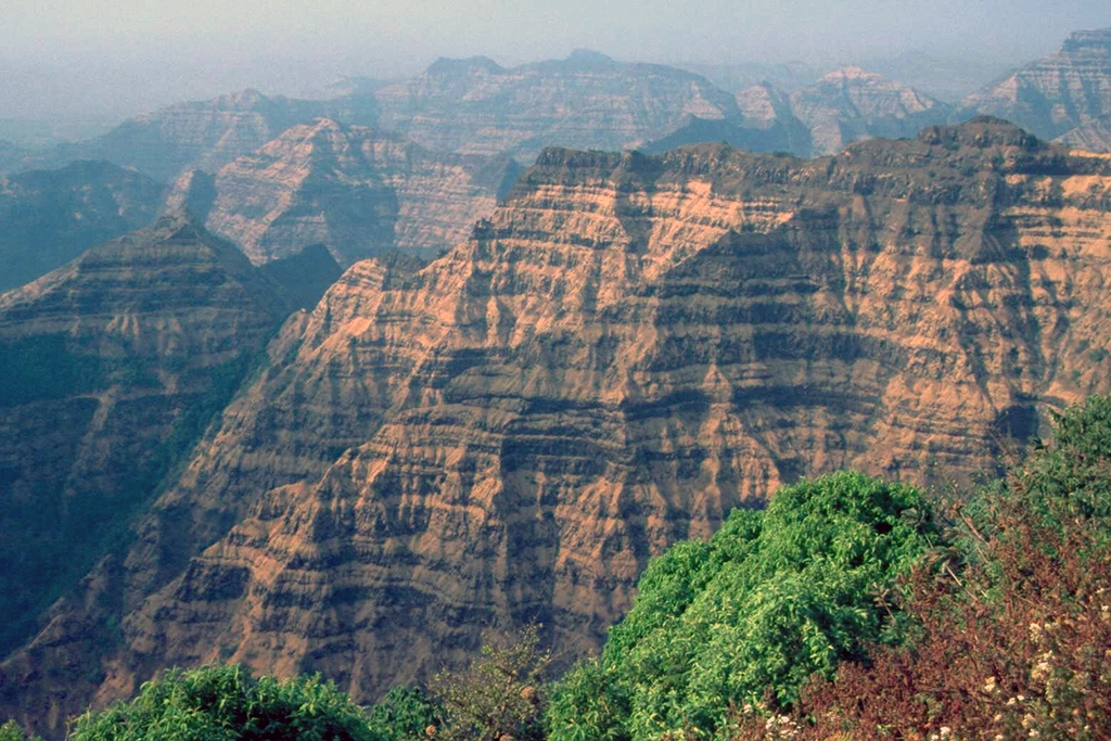
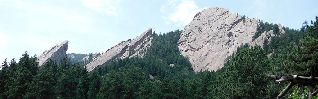
Figure 13-4. The Deccan Traps and Rocky Mountains are representive of the volcanism and tectonism of the Latest Cretaceous. The Deccan Traps of west-central India were an eruption of ~1 million km3 of mostly basaltic lava (top). |
A Correlated History of Earth: Cretaceous
The Cretaceous Period was a dynamic interval in Earth's history. Tectonic plate interactions created diverse geographies that included tectonic and volcanic mountain ranges, opening and closing ocean basins, and vast inland seaways. Plant and animal life flourished during this time, with reptiles dominating the land sea, and air and flowering plants becoming abundant. Once again, we will use the A Correlated History of Earth poster to help compare rocks, events, and life forms (see Figure 13-5).
|
|
|
|
Figure 13-5. The A Correlated History of Earth poster (left) and the portion that we will focus on in this lab (right). |
|
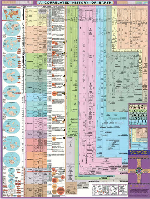
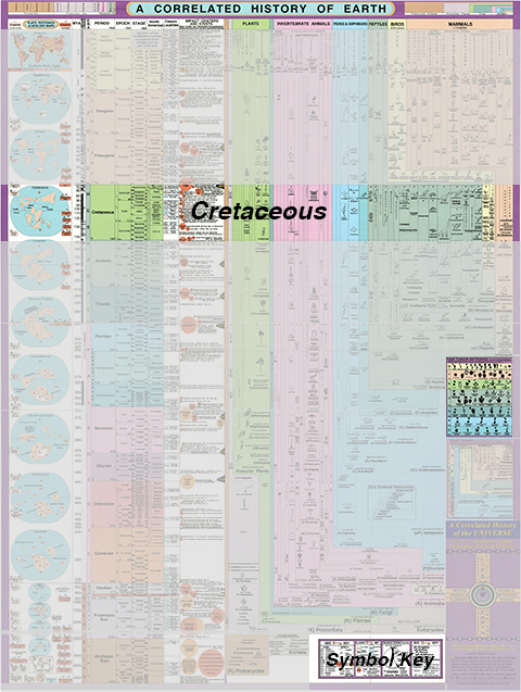
Answer Quiz Me! questions B13 through B25 using the A Correlated History of Earth poster (see the PDF link below). Today's lab will focus on the Cretaceous portion of the poster.
|
A Correlated History of Earth |
|
See the symbol key for definitions of the many map symbols and features. |
Tectonics, Volcanics, & Classic rock Units

Life Forms
Cretaceous Paleogeography
We've been using the paleogeographic maps created by DR. RON BLAKEY (NAU) to interpret past geographies of western North America. Dr. Blakey and others use rocks and fossild to interpret these ancient geographies. During the Cretaceous, this included many different sedimentary environments, both marine and terrestrial (see Figure 13-6).
|
|
|
Figure 13-6. What the Cretaceous North American Interior Seaway may have looked like. |
Go to the Paleogeography and Geologic History of the Southwestern U.S. page to answer Quiz Me! questions B11 through B15 (see the PDF link below). Refer only to the Cretaceous text and maps in the Mesozoic section.
|
Paleogeography and Geologic History of the Southwestern U.S. |
|
Tan/brown represent land areas, light blue represent shallow marine areas, and dark blue represent deep marine areas. |