Part B
Triassic & Jurassic Geology and Life Forms
The Mesozoic Era was a time of dynamic tectonics, with the rifting of the Pangea supercontinent, and the resulting formation of North America. Collisional orogenies relentlessly pounded its western margin and produced tectonic and volcanic mountain belts, as well as large foreland basins. A range of depositional environments existed, and fluvial (stream) and eolian (wind) sediments were deposited across Utah and Arizona. In particular, the Navajo Sandstone and related units represent a huge dune field (erg) that developed behind the continental arc to the west. The Mesozoic also witnessed a veritable explosion of plant and animal life, not only on land, but in the ocean and in the air.
|
|
|
|
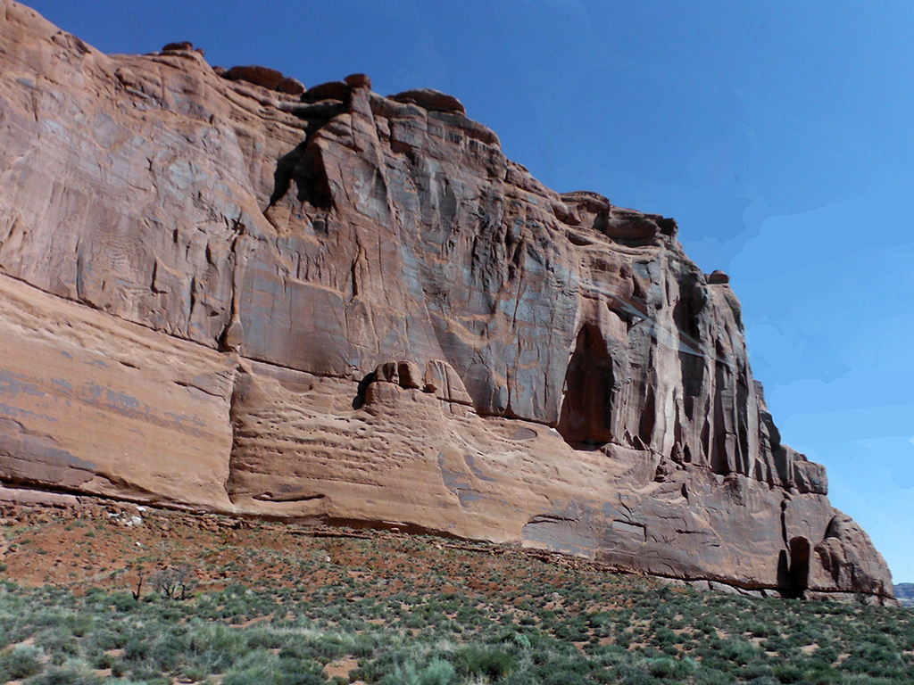
Figure 12-4. Triassic-Jurassic rock formations and fossils are abundant in southern Utah and northern Arizona. The Slickrock Member of the Jurassic Entrada Sandstone in Arches National Park, eastern Utah (left). |
|
A Correlated History of Earth: Triassic & Jurassic
Once again, we visit A Correlated History of Earth to help compare rocks, events, and life forms (see Figure 12-5). Today's lab will focus on the upper-middle portion of the poster.
|
|
|
|
Figure 12-5. The A Correlated History of Earth poster (left) and the portion that we will focus on in this lab (right). |
|

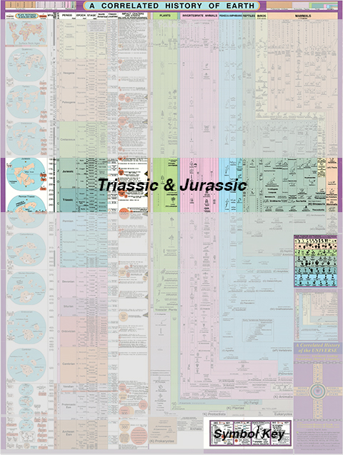
Answer Quiz Me! questions B05 through B14 using the A Correlated History of Earth poster (see the PDF link below). Refer to the Late Paleozoic (Mississippian through Permian) section to answer the questions.
|
A Correlated History of Earth |
|
See the symbol key for definitions of the many map symbols and features. |
Tectonics & Volcanics

Classic Rock Units & Impact Craters
Life Forms
Triassic & Jurassic Paleogeography
The Triassic and Jurassic Periods would signal an increase in tectonic activity across the western margin of Laurasia / North America. Subduction-related uplift, folding, and faulting occurred along with continental arc volcanism. All the while, both fluvial (stream-related) deposits and eolian (wind-related) dune sand were deposited across a wide area. Rocks and fossils of this age provide clues to the geologic environment of the early and middle Mesozoic Era (see Figure 12-6).
|
|
|
|
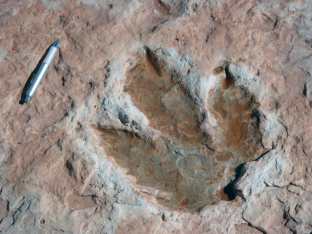
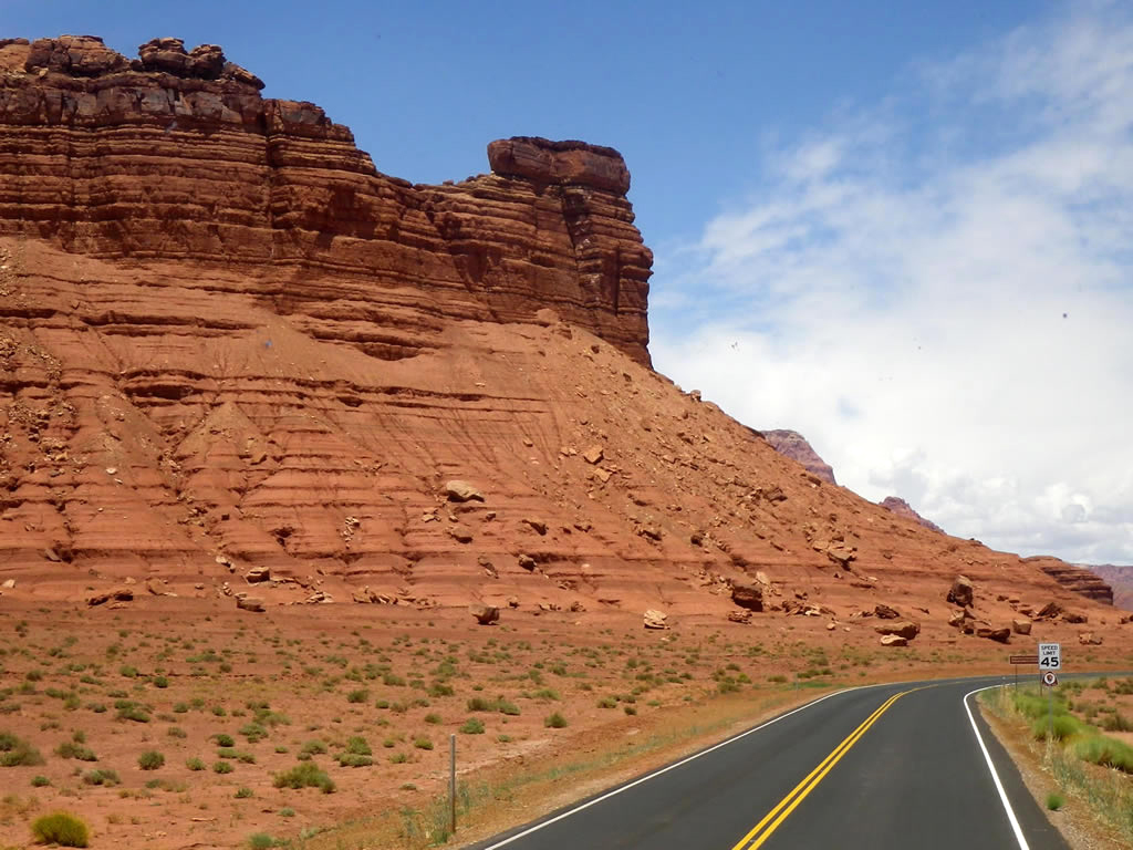
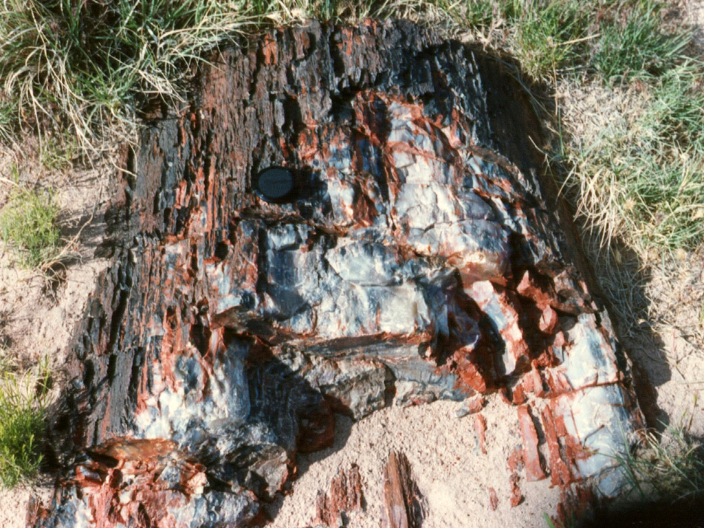
Figure 12-6. The Triassic Moenkopi and Chinle Formations of northern Arizona. At left, the Early Triassic Moenkopi Formation forms some of the reddish slopes of the Vermillion Cliffs near Lees Ferry, Arizona. These rocks may have been deposited in an arid river flood plain environment. Fossils, like this petrified log, are common in parts of the middle Triassic Chinle Formation in Petrified Forest National Park (right). |
|
Time again to review the Paleogeography and Geologic History of the Southwestern U.S. page where you can find information about Triassic and Jurassic paleogeography to answer Quiz Me! questions B15 through B18 (see the PDF link below). Refer only to the Triassic and Jurassic text and maps in the Mesozoic section.
|
Paleogeography and Geologic History of the Southwestern U.S. |
|
Tan/brown represent land areas, light blue represent shallow marine areas, and dark blue represent deep marine areas. |