Part D
Geology of the Cheops Pyramid Area
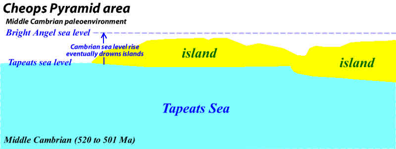
An ancient island archipelago is preserved in the middle of the Grand Canyon, notably at a place called Cheops Pyramid. During the Cambrian, this area was part of a shallow marine continental shelf along the western margin of North America. How do we know this? Let's find out.
|
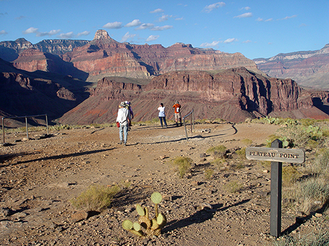
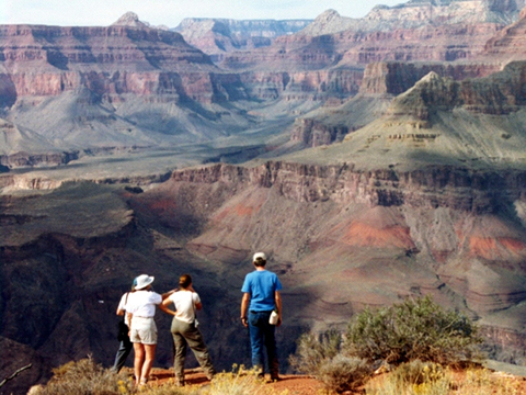
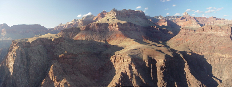
Figure 10-11. From the south side of the Inner Gorge, MCC students get two views of "Cheops Bay", the area where there were islands in the Cambrian sea. At left, from Plateau Point, where the brown cliffs of Shinumo Quartzite mark one of the islands at Utah Flats. |
|
|
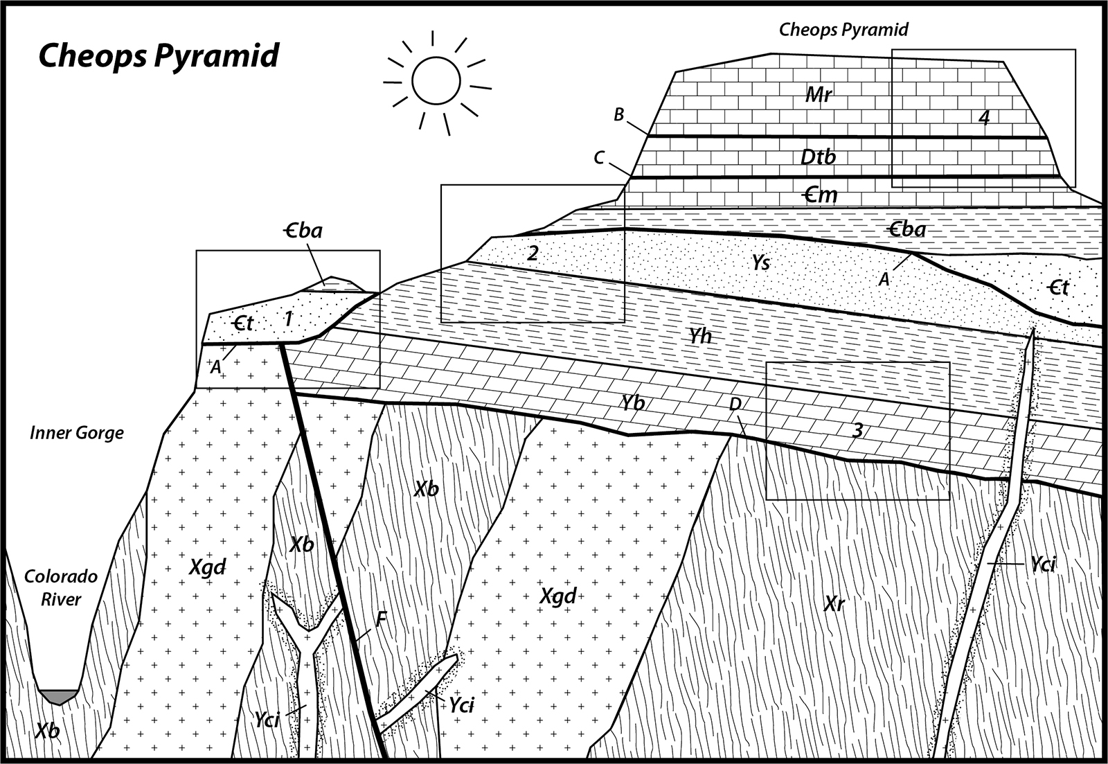
Figure 10-12. The Cheops Pyramid sequence diagram. Click HERE for a printable PDF version. |
Answer Quiz Me! questions D46 through D50 using the Cheops Pyramid sequence diagram (Figure 10-12). Print a hard-copy of the diagram if necessary (see the link below for a printable PDF version). Also refer to the Key to Map Fill Patterns (see PDF HERE).
General Interpretation
![]()
![]()
![]()
![]()
Recognizing Geologic Features in Landscapes
Be able to recognize rock units and features in a landscape is a fundamental skill in field geology. It is like recognizing landscape features using a topo map, except this is about the geology. These landscape photo matching questions typically only have a couple of rock units in each boxed area. Using the sequence diagram, you know which rock types to look for, so it comes down to recognizing the rock units in the wild (in the image). If necessary, refer to the tips from the previos lab to match the boxed locations on the Inner Gorge sequence diagram with some landscape images.
![]()
Interpreting Islands in a Cambrian Sea
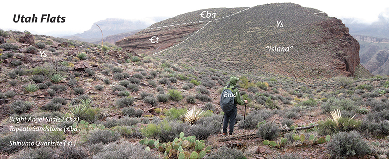
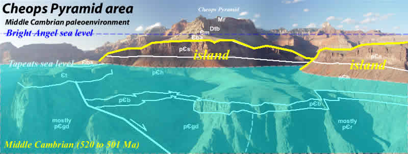
By observing geologic field relations, we can interpret the existence of islands in an ancient sea.
|
Figure 10-13. The Utah Flats island. Brad stands atop what would have been a small Shinumo Quartzite "island" in the Utah Flats area. |
|
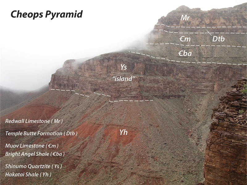
Figure 10-14. The Cheops Pyramid island. In the lower part of Cheops Pyramid, massive Shinumo Quartzite cliffs overlie slopes of Hakatai Shale. |
|
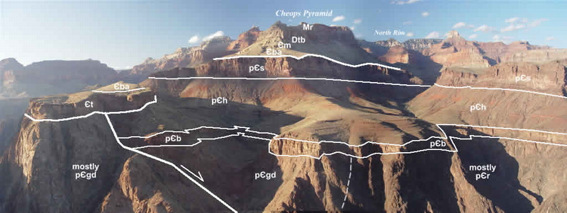
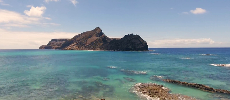
Figure 10-15. The geology and interpretation of the Cheops Pyramid area. From top to bottom: the Cheops Pyramid area as viewed from Plateau Point, with the geology labeled, and paleoenvironmental interpretations. The bottom image is actually Porto Santo Island in the Atlantic. |
After finishing this lesson, complete the form below:
