Part C
Appalachian Mountains & Grand Canyon Geology
Rocks representing the geologic history of the Early Paleozoic Era are exposed on both sides of the North American continent. Early Paleozoic sedimentary rocks of the Appalachian Mountains were deposited and subsequently deformed into folds by various collisional mountain-building events. Rocks of similar age and composition are also present in the Grand Canyon, where four separate rock units form the lowest relatively horizontal units above the Precambrian Inner Gorge.
|
|
|
|
|
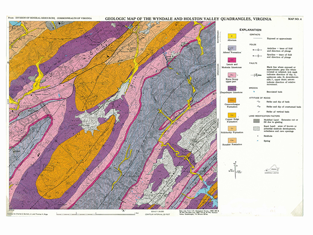
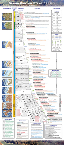
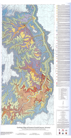
Figure 10-7. Early Paleozoic geology is well exposed on both sides of North America. We will study this geology using geologic maps and an infographic. The Geologic Map of the Wyndale and Holston Valley Quadrangles, Virginia (left), the Grand Canyon Stratigraphy poster (middle), and the Geologic Map of Eastern Grand Canyon (right). |
||
Geologic Map of the Wyndale and Holston Valley Quadrangles
This area of the Appalachian Mountains is located along the southwestern Virginia border with northeastern Tennessee. The sedimentary layers of the anticlines and synclines form linear valleys and ridges. Sinkholes and caves are common and locally form in carbonate rocks across the area.
|
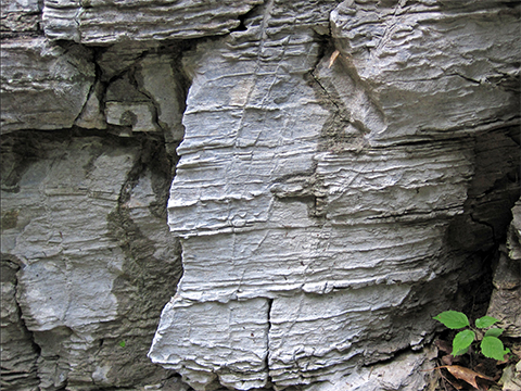
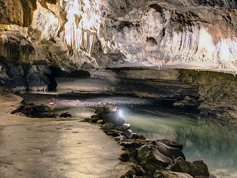
Figure 10-8. Paleozoic rocks and cool locations of southwestern Virginia. At left, an outcrop of the Ordovician Chepultepec Limestone (James St. John). |
|
Answer Quiz Me! questions C21 through C29 using the Geologic Map of the Wyndale and Holston Valley Quadrangles (see the PDF link below). If necessary, refer to the Sedimentary Rock Identification Chart (see PDF HERE).
|
Geologic Map of the Wyndale and Holston Valley Quadrangles |
Explanation
![]()
![]()
![]()
Geologic Map
![]()
![]()
![]()
![]()
![]()
![]()
Grand Canyon Stratigraphy
Throughout the Grand Canyon, Early Paleozoic rocks include the roughly flat-lying Tapeats Sandstone, Bright Angel Shale, and Muav Limestone. These sedimentary units combine to form the Tonto Group and cover the older Inner Gorge basement rocks from the confluence of the Colorado and Little Colorado rivers in the east to the Grand Wash Cliffs at Lake Mead in the west. The younger Temple Butte Limestone is a localized channel-filling unit in the east, but thickens to the west into a continuous, sheet.
|
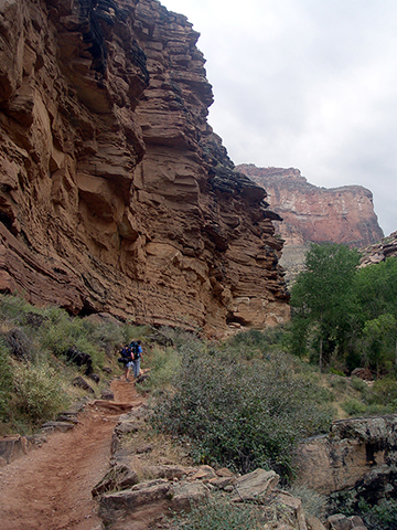
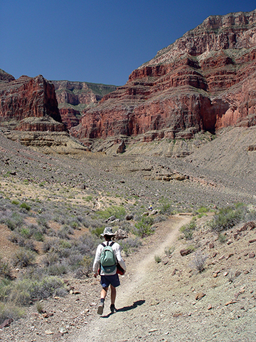
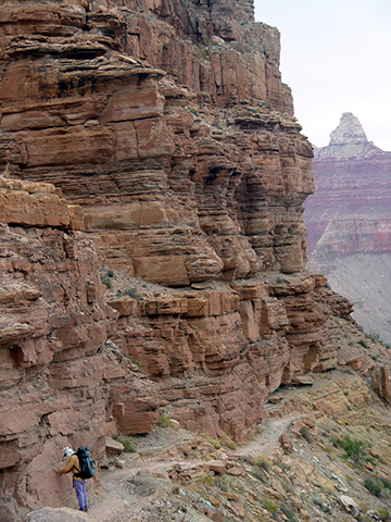
Figure 10-9. MCC students see Cambrian rocks on hikes in the Grand Canyon. Bonnie and Patrick traverse the Tapeats Sandstone on the Bright Angel trail (left), Ford hikes across the slopes of Bright Angel Shale on the Tonto trail (middle), and Brad inspects the Muav Limestone on the South Kaibab trail (right). |
||
Answer Quiz Me! questions C30 through C37 using the Grand Canyon Stratigraphy poster (see the PDF link below).
|
Grand Canyon Stratigraphy |
Rock Units
![]()
![]()
Rock Unit Correlation
![]()
Rock Types
![]()
![]()
![]()
![]()
Waterfalls & Springs
![]()
Geologic Map of the Eastern Grand Canyon Area
Throughout the Grand Canyon, Early Paleozoic rocks include the roughly flat-lying Tapeats Sandstone, Bright Angel Shale, and Muav Limestone. These sedimentary units combine to form the Tonto Group and cover the older Inner Gorge basement rocks from the confluence of the Colorado and Little Colorado rivers in the east to the Grand Wash Cliffs at Lake Mead in the west. The younger Temple Butte Limestone is a localized channel-filling unit in the east, but thickens to the west into a continuous, sheet.
|
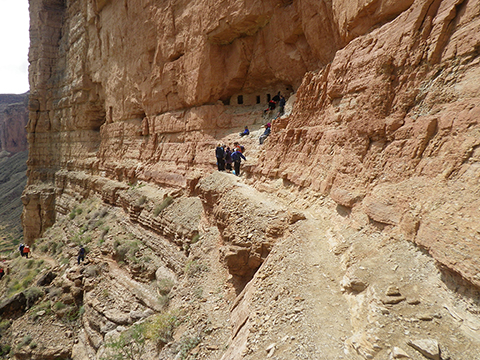
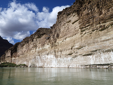
Figure 10-10. Early Paleozoic rocks in the eastern Grand Canyon. At left, the Nankoweap granary etched into cliffs of Muav Limestone / Unclassified Dolomites 600 feet above the Colorado River (river mile 52.8). At right, cliffs of Tapeats Sandstone draped with groundwater-deposited evaporites at "the Hopi salt mines" (river mile 63.6). |
|
Answer Quiz Me! questions C36 through C45 using the Geologic Map of Eastern Grand Canyon (see the PDF links below). If necessary, refer to the Sedimentary Rock Identification Chart (see PDF HERE).
|
Geologic Map of Eastern Grand Canyon |
|
(it's a big map, so it may take a minute to load) River miles are marked on the map. |
|
Geologic Map of Eastern Grand Canyon - Cross Section A-A' |
Geologic Map
![]()
![]()
![]()
![]()
![]()
![]()
Cross Section A-A'
![]()
![]()
