Part D
Geology of Cedar Ridge
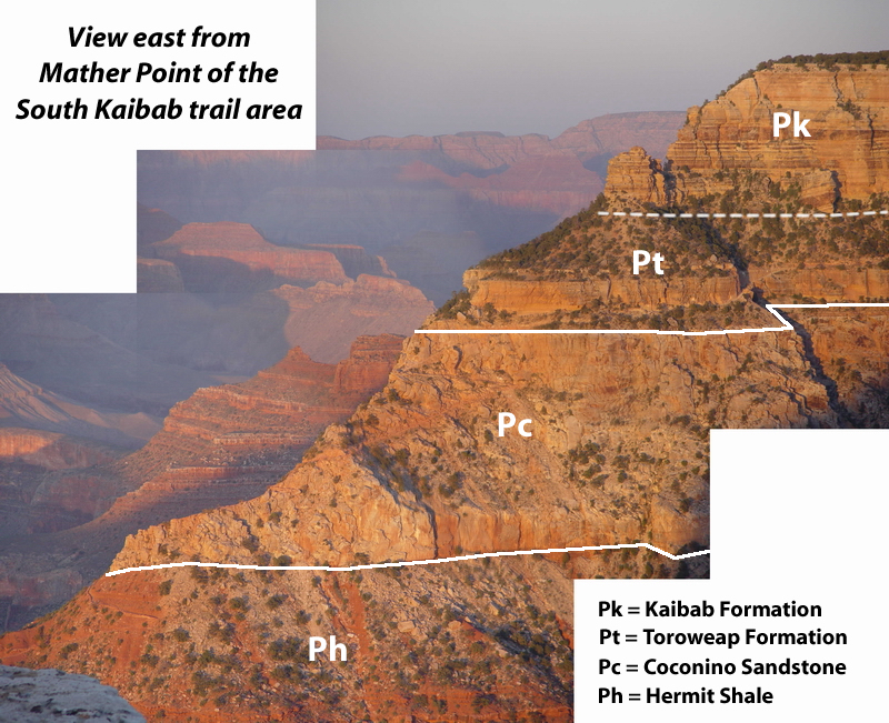
Let's take a look at the Cedar Ridge area of the Grand Canyon, where several important Late Paleozoic units are exposed along the South Kaibab trail. With its trailhead near Yaki Point,on the South Rim this is popular rim-to-river trail is relatively steep, but affords great rock exposures and canyon views.
|
|
|
Figure 11-11. A view of the South Kaibab trail area south of Cedar Ridge. Click on the image to see an annotated version. |
|
|
|
Figure 11-12. The Cedar Ridge sequence diagram. Click HERE for a printable PDF version. |
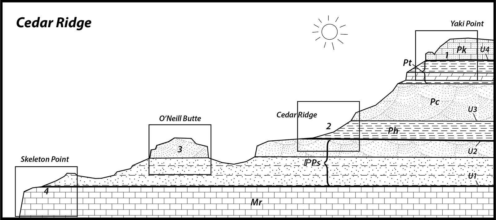
Answer Quiz Me! questions D44 through D50 using sequence diagram in Figure 11-12. Print a hard-copy of the diagram if necessary (see the PDF link below). If necessary, also refer to the Key to Map Fill Patterns (see PDF HERE) and the Sedimentary Rock Identification Chart (see PDF HERE).

After finishing this lesson, complete the form below: