Part C
Geologic Maps With Metamorphic Rocks & Geologic Structures
Metamorphic rocks are locally exposed across Arizona, from the bottom of the Grand Canyon to some of the mountain ranges in southern Arizona. The largest exposures of metamorphic rocks are in the rugged mountains of central Arizona. Geologic structures of various types and sizes are also exposed across Arizona and thoughout much of the Rocky Mountains regio
|
|
|
|
|
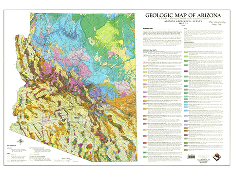
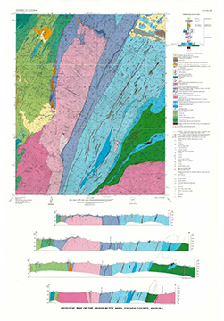
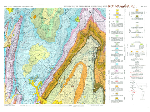
Figure 7-18. Metamorphic rocks and geologic structures offer more clues about Earth's geologic history. The Geologic Map of Arizona (left), the Geologic Map of the Brady Butte Quadrangle (middle), and the Geologic Map of the Devils Fence Quadrangle (right). |
||
Geologic Map of Arizona
Answer questions C26 through C29 using the Geologic Map of Arizona (see the PDF link below). If necessary, you can also refer to the Metamorphic Rock Identification Chart.
|
Geologic Map of Arizona |
Geologic Map Units
![]()
![]()
![]()
Geologic Map
![]()
Geologic Map of the Brady Butte Area
The Brady Butte area is a rugged wilderness area in the Bradshaw Mountains of central Arizona. Access to the Paleoproterozoic geology of this area is limited, except for the highly washboarded road leading to Crown King and the Senator Highway in the southernmost part of the map area. The Proterozoic rocks of the Bradshaw Mountain host abundant ore deposits that were prospected and mined in in the late 1800's and early 1900's.
Answer Quiz Me! questions C30 through C39 using the Geologic Map of the Brady Butte Area (see the PDF link below).
|
Geologic Map of the Brady Butte Area |
Description of Map Units & Symbols
![]()
![]()
![]()
![]()
Geologic Map
![]()
![]()
![]()
![]()
Cross Sections
![]()
![]()
Geologic Map of the Devils Fence Quadrangle
Answer Quiz Me! questions C40 through C45 using the Geologic Map of the Devils Fence Quadrangle (see the PDF link below). If necessary, you can also refer to the Metamorphic Rock Identification Chart.
|
Geologic Map of the Devils Fence Quadrangle |
Explanation
![]()
![]()
Geologic Map
![]()
![]()
![]()
![]()


