Part B
Basin and Range
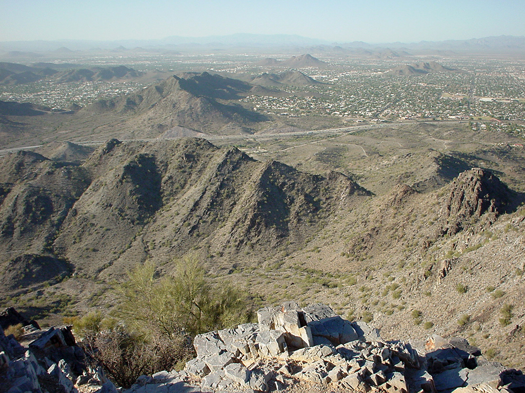
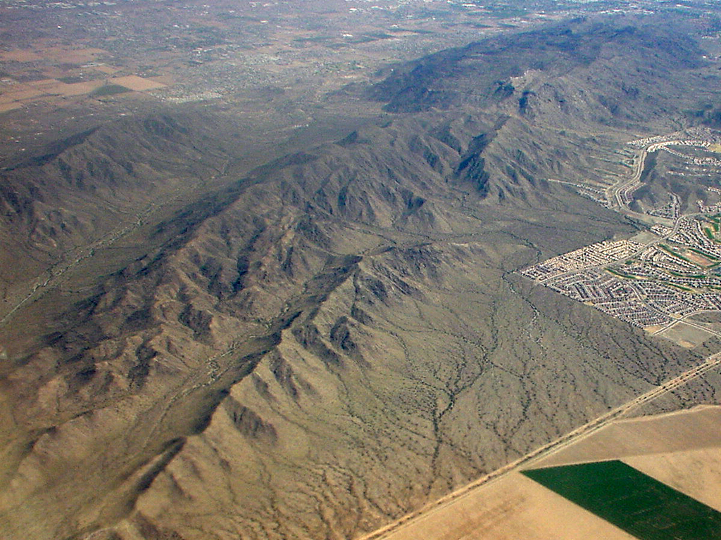
The Basin and Range of southern Arizona is a region of broad valleys and basins that are separated by mountain ranges. Most of this physiographic province has a relatively low overall elevation and lies within the Sonoran and Chihuahuan deserts. The Gila River and its tributaries flow westward, eventually into the Colorado River on the western border of the state. Some of the larger lowland areas include the Phoenix basin and Tucson basin. Smaller mountainous areas have much higher elevations, and include the Sierra Estrella and South Mountains near Phoenix, the Santa Catalina and Rincon Mountains near Tucson, the Pinaleno and Chiricahua Mountains of southeastern Arizona, etc. The sizes of the basins and ranges vary as weathering and erosion have reduced the extent of some of the mountains. The geology of the mountains is quite diverse, from Proterozoic igneous and metamorphic rocks to Tertiary volcanic rocks. The basins are largely filled with Quaternary and Tertiary sedimentary debris eroded from the mountains. Alluvial fans and playas are locally prominent, with widespread stream and wind deposits.
|
|
|
|
Figure 12-4. The landscape and geology of the Phoenix-area Basin and Range. The view northwest of the Phoenix Mountains from the summit of Piestewa Peak (left). |
|
Geologic Map of the Silver City 1°x 2° Quadrangle
The Geologic Map of the Silver City 1° x 2° Quadrangle (Figure 12-5) is located in the southeastern corner of Arizona, and continues on into New Mexico's Basin and Range. Several priminent mountain ranges, like the Pinaleno Mountains and Chiricahua Mountains, stand in marked relief above lower desert basins like the Sulphur Springs Valley and Animas Valley.
|
|
|
|
Figure 12-5. Southeastern Arizona's Basin and Range. The Geologic Map of the Silver City 1° x 2° Quadrangle covers the Basin and Range of southeastern Arizona and southwestern New Mexico (left). |
|
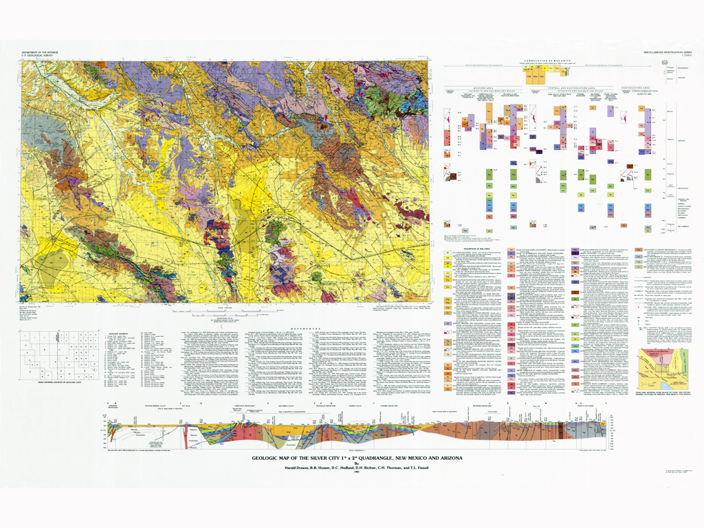
Answer Quiz Me! questions B06 through B20 using the Geologic Map of the Silver City 1°x 2° Quadrangle (see the PDF link below). Also, feel free to refer to your rock identification charts.
|
Geologic Map of the Silver City 1°x 2° Quadrangle |
Safford Area
Willcox Playa
Geologic Cross Section