Part A
Landscapes of Arizona
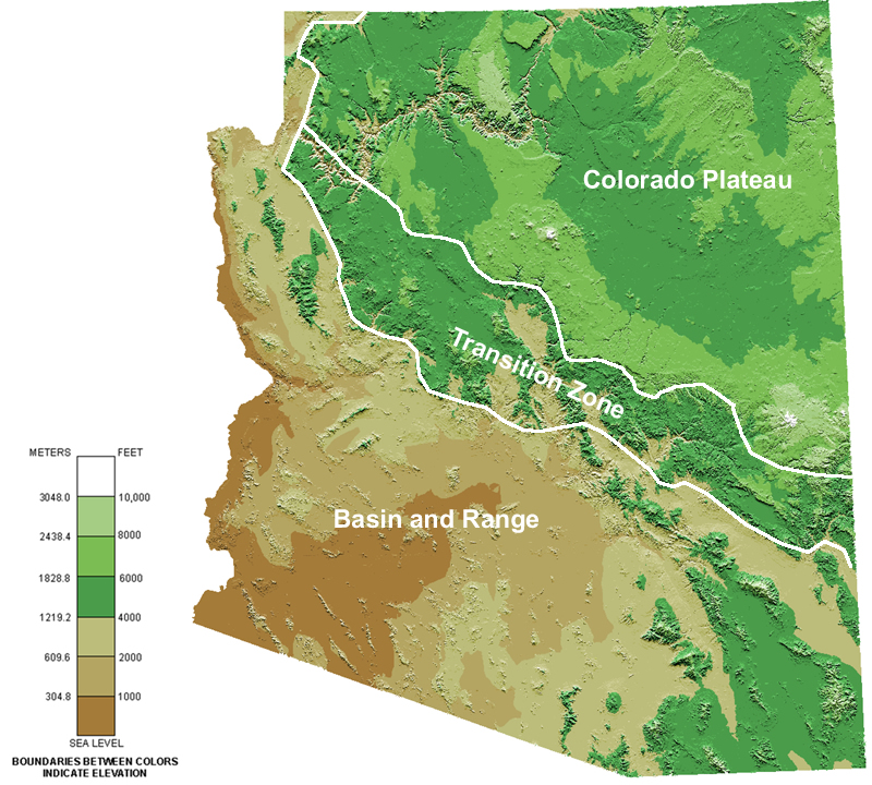
The color-coded map in Figure 12-2 shows clear differences in the elevations across Arizona. In general, the southern part of Arizona is much lower in elevation (more tan and brown color) than the northern portion of the state (more green). The landscape of Arizona can be subdivided into three main physiographic (or landscape) provinces: the Basin and Range, the Colorado Plateau, and the Transition Zone. Each province has distinctive landscape features and characteristics. As we will see, these provinces share similarities and differences in their geology also.
|
|
|
Figure 12-2. A color topographic map of Arizona showing the main physiographic boundaries. |
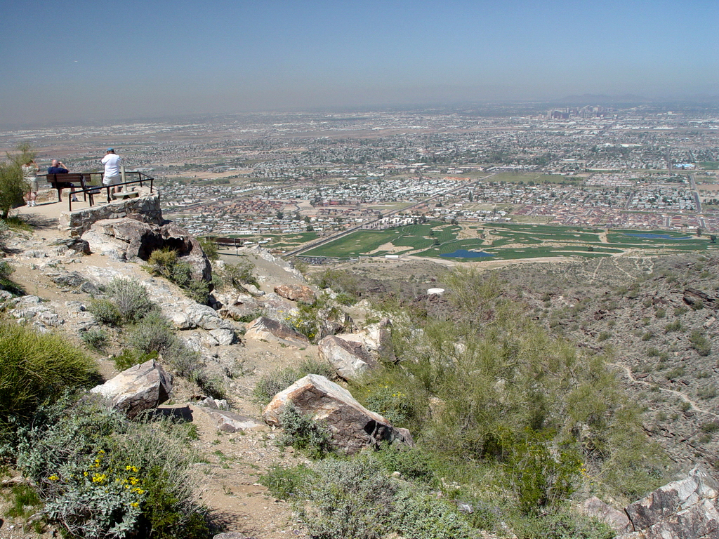
Basin and Range
> Broad valleys having low average elevations separated by mountain ranges of moderate to high elevations.
> Major cities - Phoenix, Tucson, Yuma, Kingman.
> Major rivers - Colorado, Gila, Salt, Santa Cruz.
Transition Zone
> Rugged, mountainous terrain with relatively high average elevations, and a few large basins.
> Major cities - Prescott, Payson.
> Major rivers - Verde, Gila, Salt.
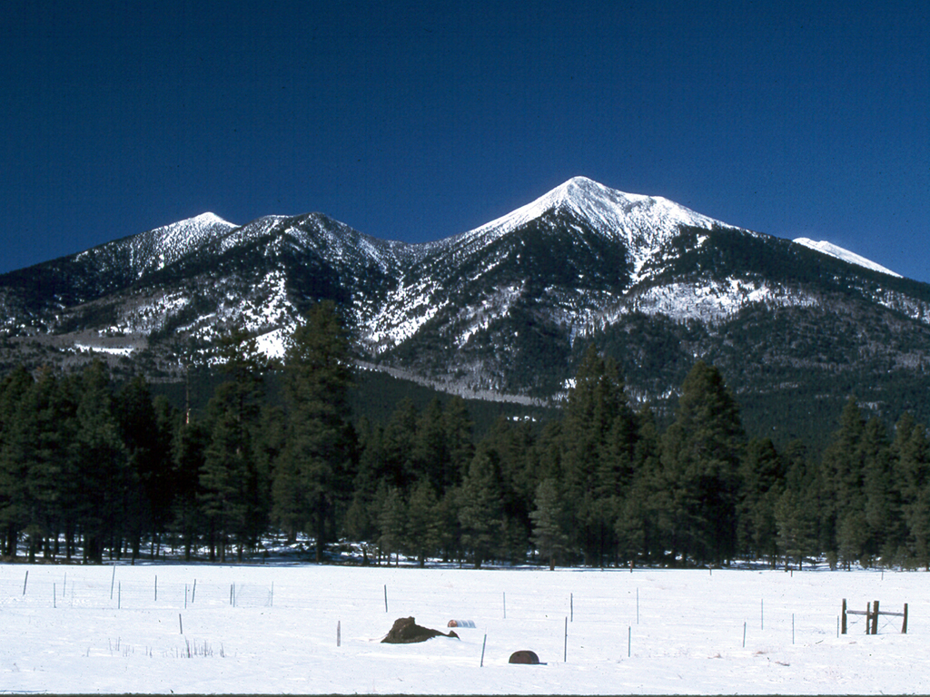
Colorado Plateau
> Broad, high elevation mesas and plateaus, deeply incised stream drainages, and isolated volcanic mountains.
> Major cities - Flagstaff, Winslow, Holbrook.
> Major rivers - Colorado, Little Colorado.
|
|
|
|
Figure 12-3. The landscapes of southern Arizona are dramatically different from those of northern Arizona. A Basin and Range view from South Mountain toward downtown Phoenix (left). |
|
Before we look at the geology of each physiographic province, let's look and the landscapes.