Prelude
The combination of geologic information with topographic maps can be a very powerful and useful tool to describe and interpret the Earth. Geologic maps portray the location, distribution, and age of many kinds of natural features, like rock units, mountains, faults, folds, mineral deposits, etc., and may also include information about subsurface features. Data from these maps are important in many types of human activity, like land-use planning, hazard assessment (earthquakes, volcanoes, flooding), etc. Students at all levels in geology can learn to read, interpret, and construct geologic maps to better describe and understand the geology around us.
|
|
|
|
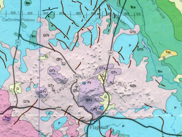
Figure 3-1. Geologic maps contain a wealth of information about the geology and landscape of an area. Part of the Geologic Map of Arizona showing the Flagstaff area (left). Remember to click on highlighted images to see larger versions. |
|
What Will You Do Today?
|
|
Read and interpret geologic maps and cross sections that describe the geology of the world around us |
A. Geologic Map Basics - Learn to read and interpret geologic maps and cross sections, including one from central Arizona
B. Geologic Map of Arizona - Practice your geologic map reading with the Geologic Map of Arizona
C. Geologic Time - Learn the basics of geologic time
D. Relative Geologic Dating Principles & Sequence Diagrams - Learn about important relative age dating principles, sequence diagrams, and unconformities