Part C
Igneous Rocks in Geologic Maps
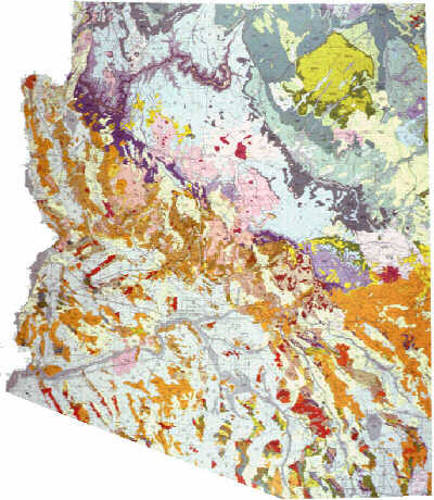
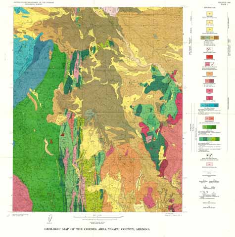
Igneous rocks are important components to many terranes around the world. Igneous rocks are displayed on many different geologic maps, including many in Arizona. Let's look more closely at igneous rocks in two geologic maps: the Geologic Map of Arizona and the Geologic Map of the Cordes Area in Yavapai County, Arizona (near Prescott).
|
|
|
|
Figure 4-10. Plutonic and volcanic igneous rocks are mostly expose across much of Arizona. The 1988 version of the Geologic Map of Arizona (left) and the Geologic Map of the Cordes Area, Yavapai County, Arizona (right). |
|
Geologic Map of Arizona
Answer questions C21 through C30 using the Geologic Map of Arizona (see the PDF link below).
|
Geologic Map of Arizona |
Map Scale
![]()
Geologic Map Units & Rock Samples
![]()
![]()
![]()
![]()
![]()
![]()
![]()
Geologic Map
![]()
![]()
Geologic Map of the Cordes Area, Yavapai County, Arizona
Answer questions C31 through C40 using the Geologic Map of the Cordes Area, Yavapai County, Arizona (see the PDF link below).
|
Geologic Map of the Cordes Area |
|
The Precambrian unit symbols on this map do not follow the same guidelines as on the Geologic Map of Arizona (i.e., the first letter is not capitalized and does not necessarily represent the geologic period age of the map unit). |
Map Scale
![]()
Explanation & Rock Samples
![]()
![]()
![]()
![]()
![]()
![]()
Geologic Map
![]()
![]()
![]()

