
| |
|
|
|
Grand
Canyon |
| North
Rim |
Images |
|
Walhalla
Plateau |
|
|
Saturday
September 25, 2004 (Day 2) |
|
|
Point Imperial / Vista Encantada / Point Roosevelt / Cape Final Hike / Cape Royal / Point Imperial Sunset / Camp |
|
| |
|
|
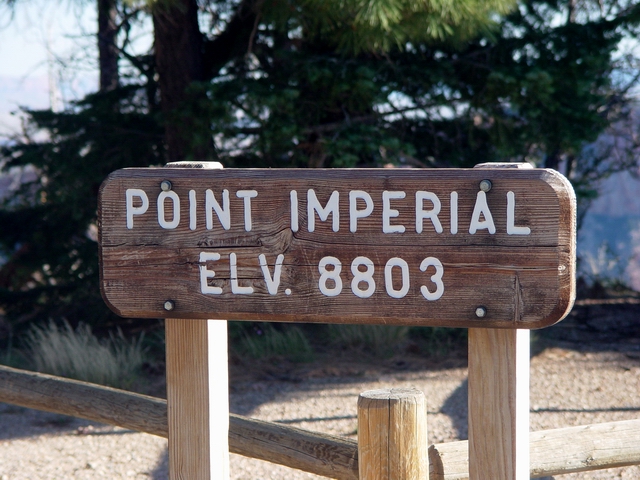
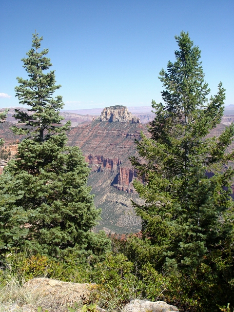
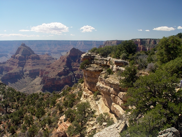
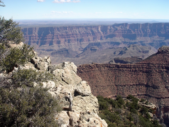
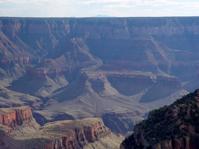
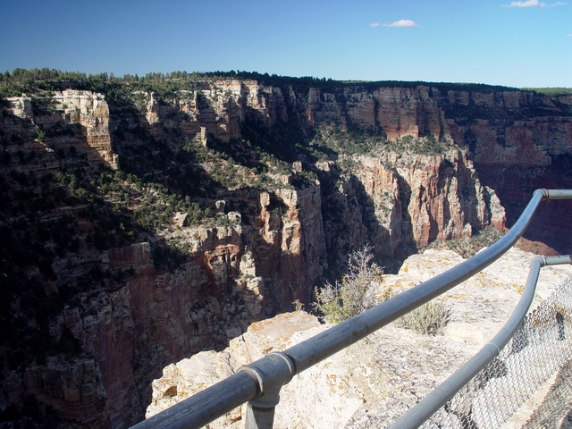
Point Imperial |
|
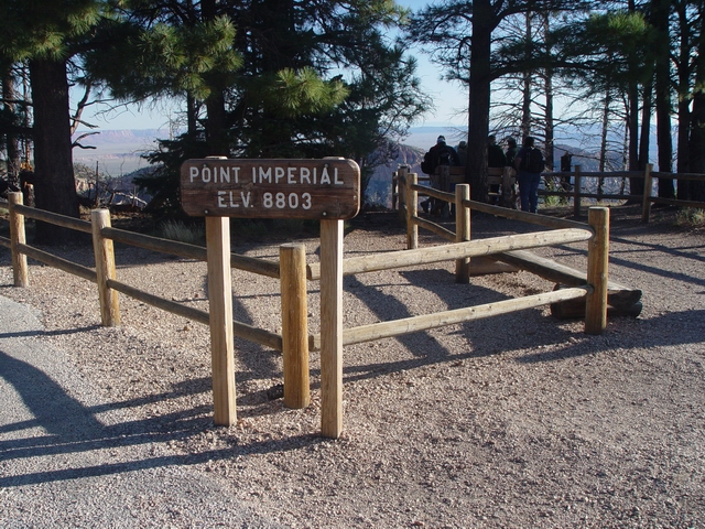 |
Point
Imperial (Leighty) Our first stop of the day. This is the northernmost of the Walhalla Plateau overlooks that is accesible by a paved road. Point Imperial was formerly named Skidoo Point. |
 |
Point
Imperial (Leighty) |
 |
Point
Imperial (Leighty) |
 |
Imperial
view north (Leighty) |
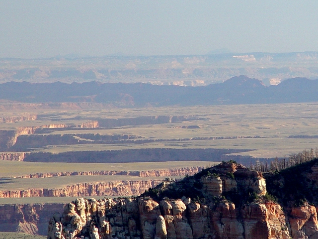 |
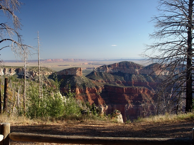
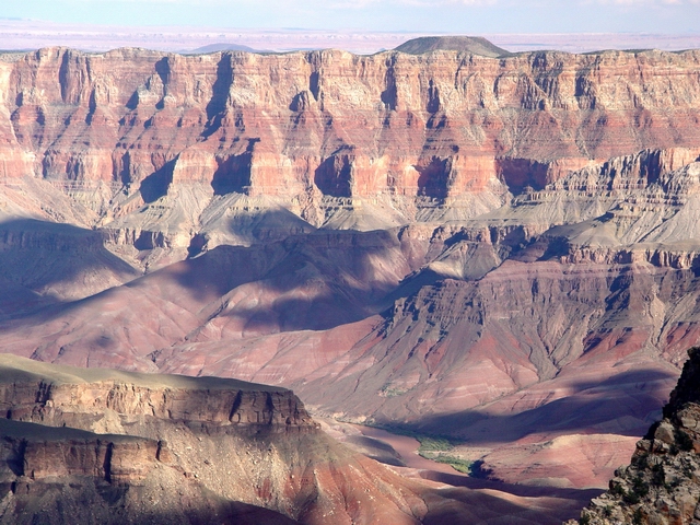
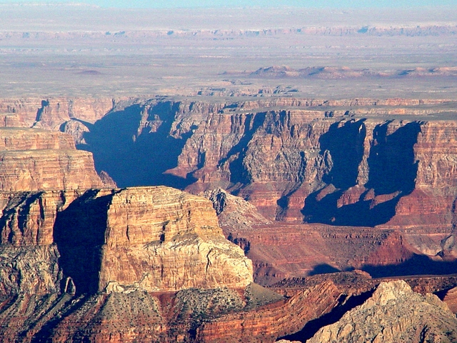
Echo
Cliffs and Marble Canyon (Leighty) The view north from Point Imperial. The Echo Cliffs are in shadow. |
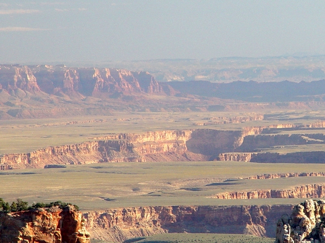 |
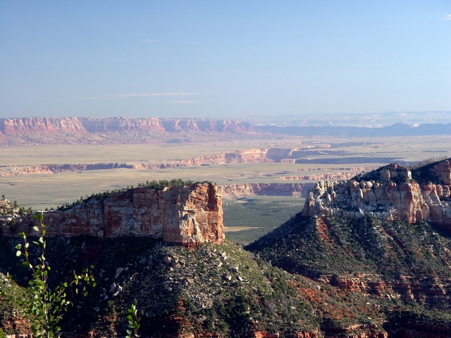
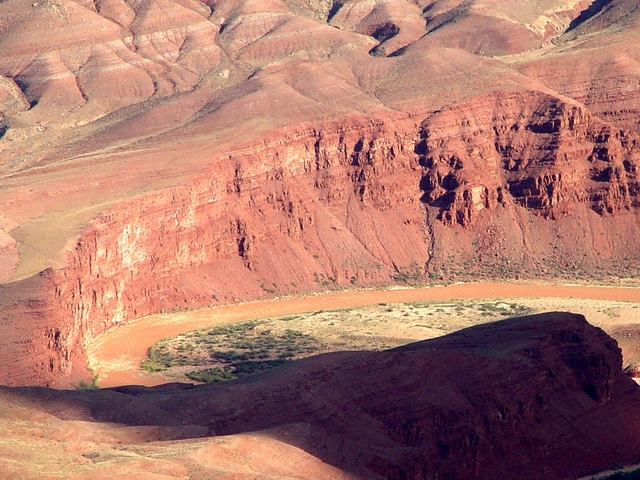
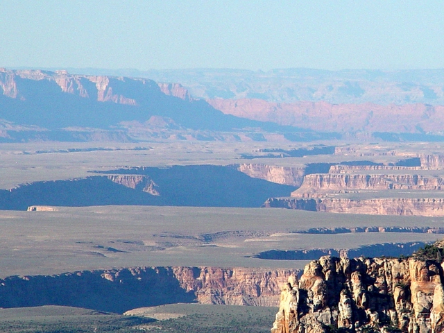
Marble
Canyon and the Vermillion Cliffs (Leighty) Marble Canyon is roughly 2500 feet deep in this area. |
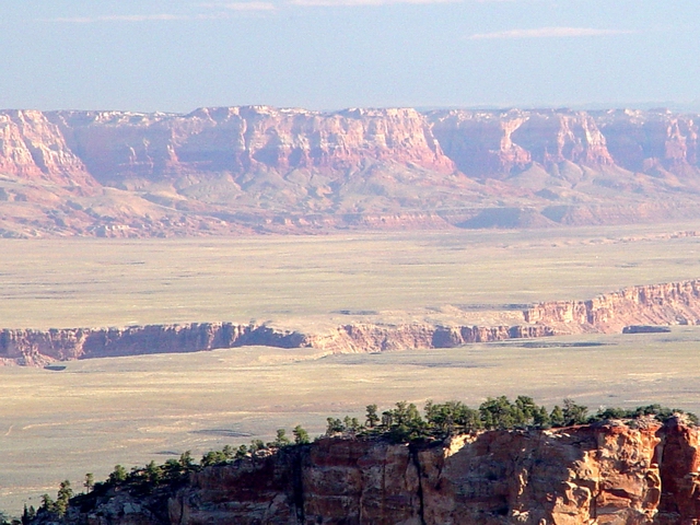 |
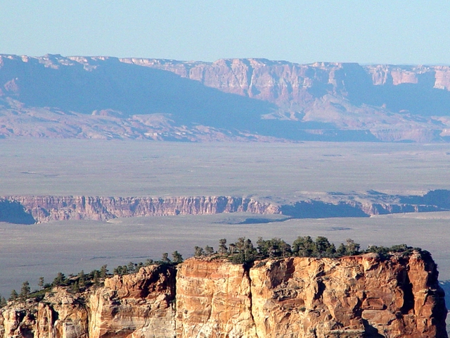
Vermillion
Cliffs and House Rock Valley (Leighty) House Rock Valley is underlain by the Permian Kaibab Formation, whereas the Vermillion Cliffs are formed by Triassic and Jurassic sedimentary rocks. |
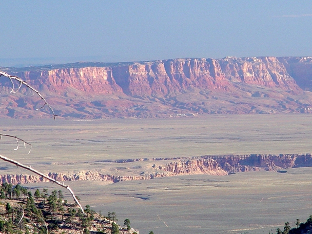 |
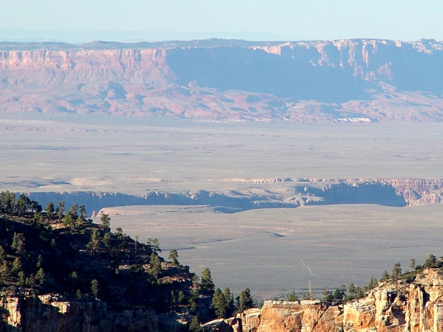
Vermillion Cliffs (Leighty) These cliffs a part of the lower portion of the "Grand Staircase", a series of escarpments of different ages in northern Arizona and southern Utah. |
 |
Navajo Mountain (Leighty) |
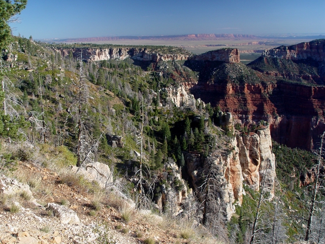 |
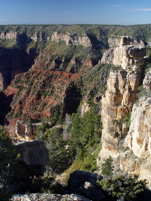
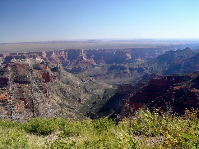
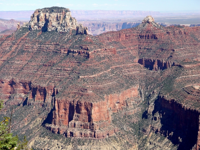
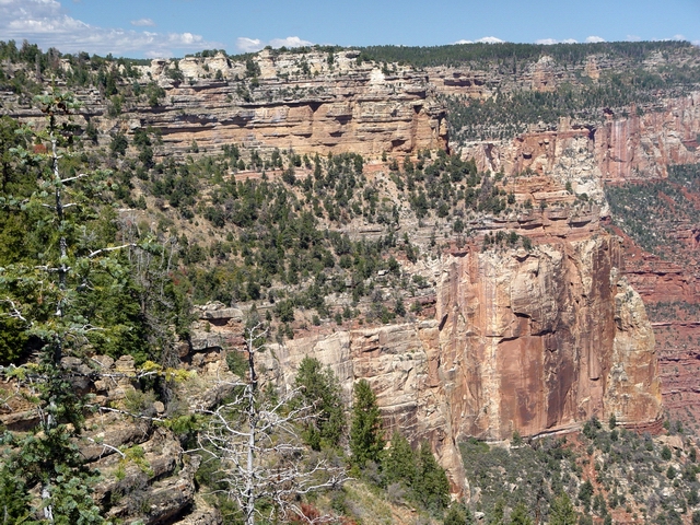
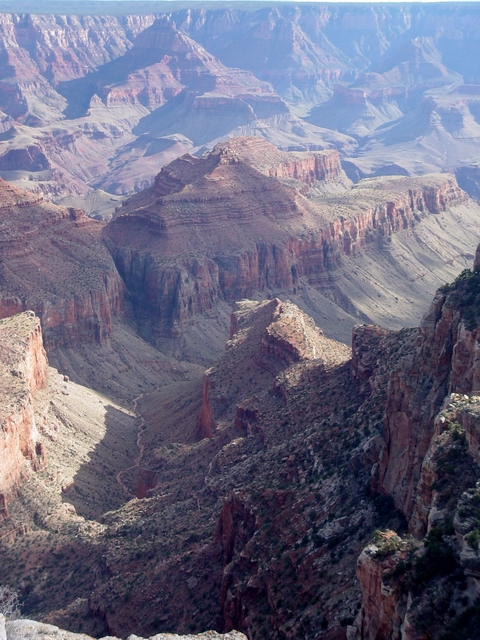
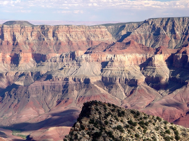
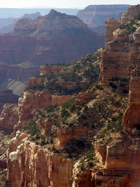
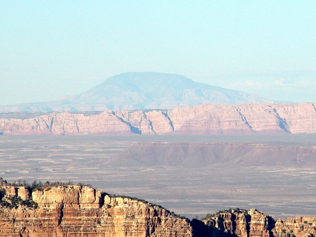
View
north from Point Imperial (Leighty) The forested cliffs and slopes of the Kaibab and Toroweap Formations give way to the massive, light-colored cliffs of the Coconino Sandstone below. See PANORAMA. |
 |
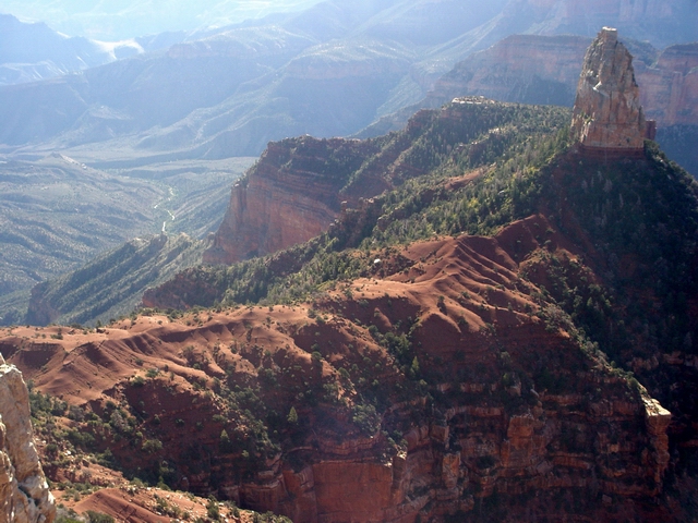
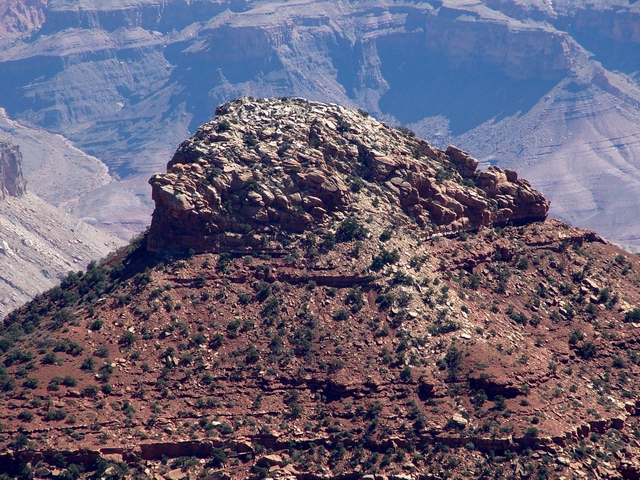
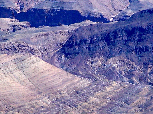
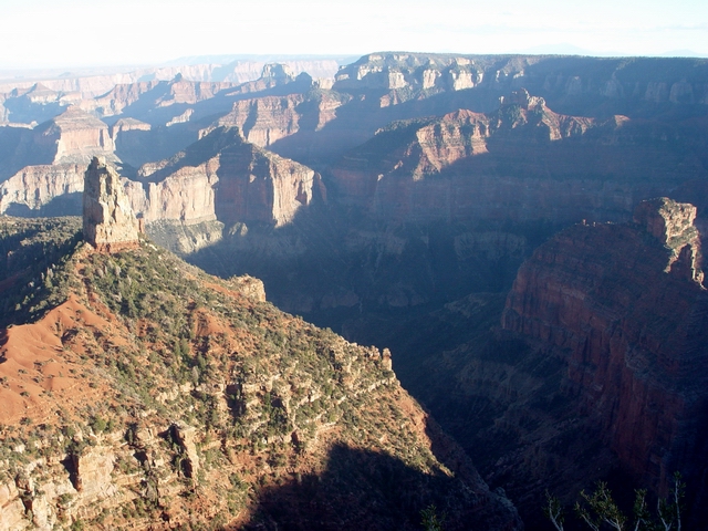
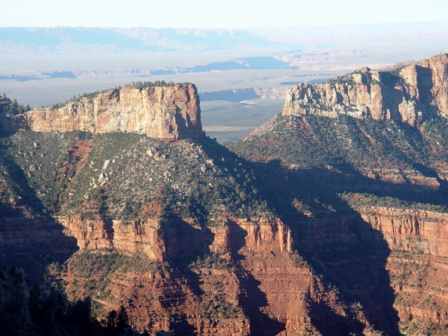
Boundary
Ridge (Leighty) Saddle Mountain is the most prominent feature on the Boundary Ridge. Saddle Mountain is capped by the Kaibab Formation. Seiber Point lies at the end of the ridge in the middleground and is underlain by the Redwall Limestone. Seiber Point is named for Al Sieber, U.S. army scout for General Crook during Apache wars led by Geronimo. |
 |
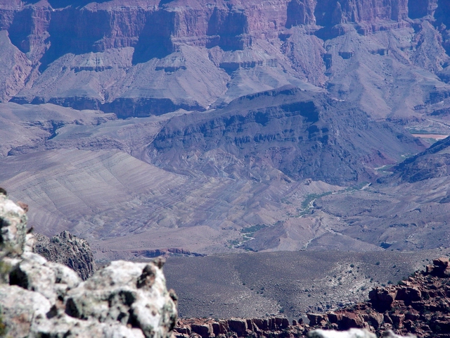
Seiber
and Marion (Leighty) Seiber Point and Marion Point (both capped by Redwall Limestone) are visible below and to the right of Saddle Mountain (upper left). The Colorado River is accessible via the Nankoweap Trail, which winds its way down the south side of the Boundary Ridge to Nankoweap Creek. There are more than 40 archeological sites in Nankoweap Canyon, named by Powell on his second trip. Nankoweap is a Pae Ute word meaning "singing canyon" or "echo canyon". |
 |
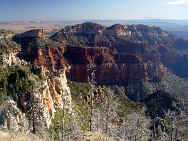
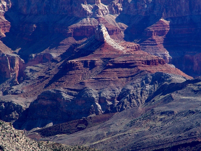
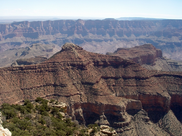
Imperial
Kaibab (Leighty) Light-colored cliffs of the Kaibab Formation are exposed at Point Imperial. See PANORAMA. |
 |
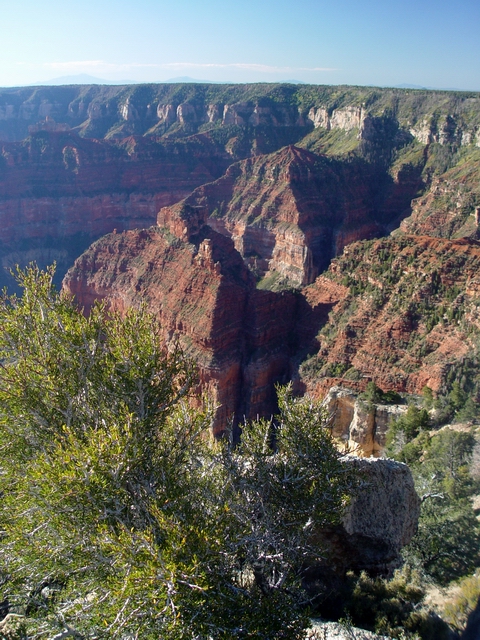
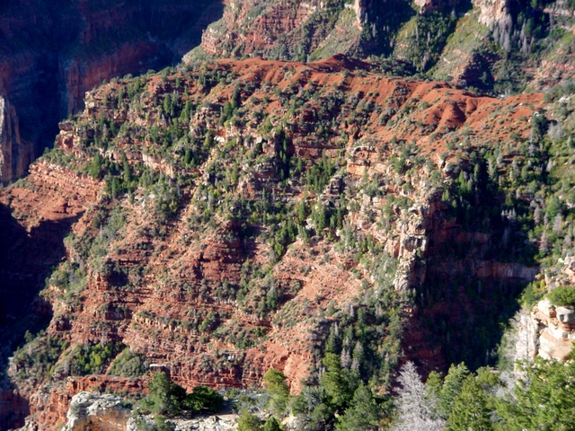
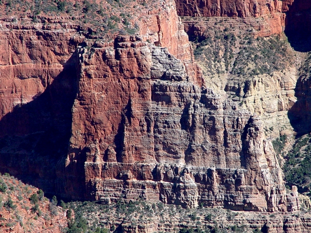
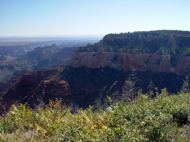
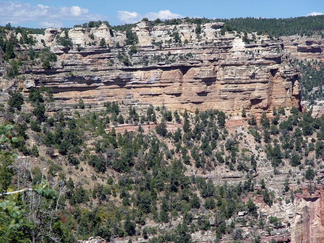
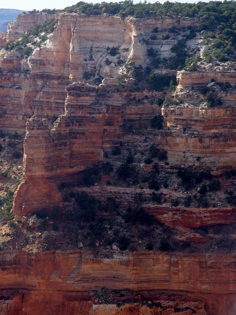
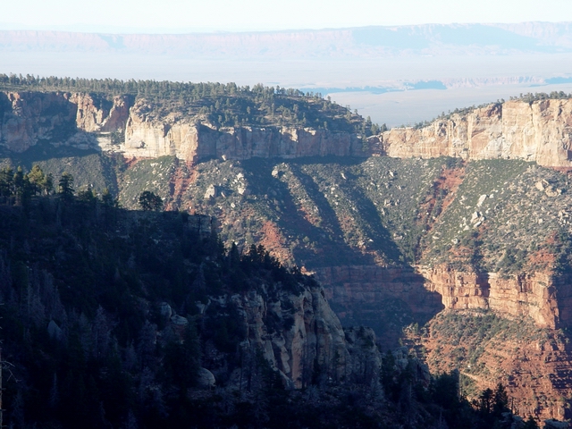
Walhalla
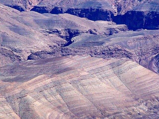
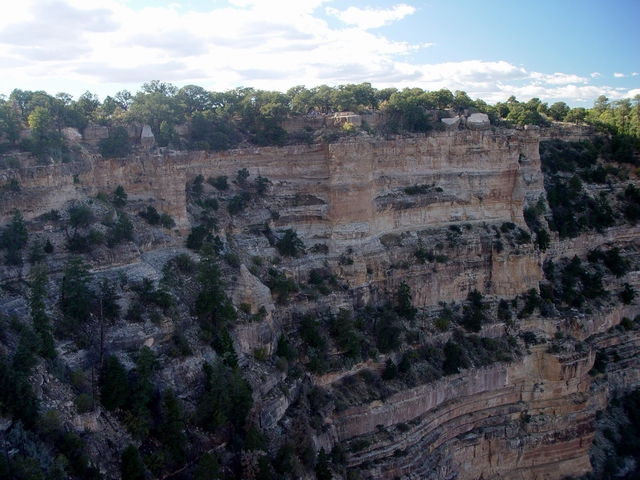
rim (Leighty) The Walhalla Plateau rim is capped by tree-covered Kaibab and Toroweap Formations. Prominent, light-colored cliffs of Coconino Sandstone are exposed below, with a thick reddish sequence of the Hermit Shale and Supai Group below that. This Permian sequence represents a marine transgression: a river floodplain (Hermit) and coastal dune complex (Coconino) were eventually covered by a shallow sea (Toroweap and Kaibab). |
 |
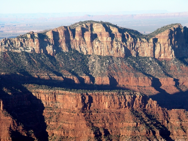
Hancock
and Kibbey (Leighty) Supai Group rocks form Hancock Butte (middle left), whereas Hermit Shale caps Kibbey Butte (behind and to the right). Several volcanic mountains are barely visible on the Walhalla Plateau skyline. Hancock Butte is named by Frank Bond for Captain William A. Hancock, an early pioneer who surveyed the townsite of Phoenix. Kibbey Butte is named for Joseph H. Kibbey, an early Arizona pioneer around the end of the nineteenth century. |
 |
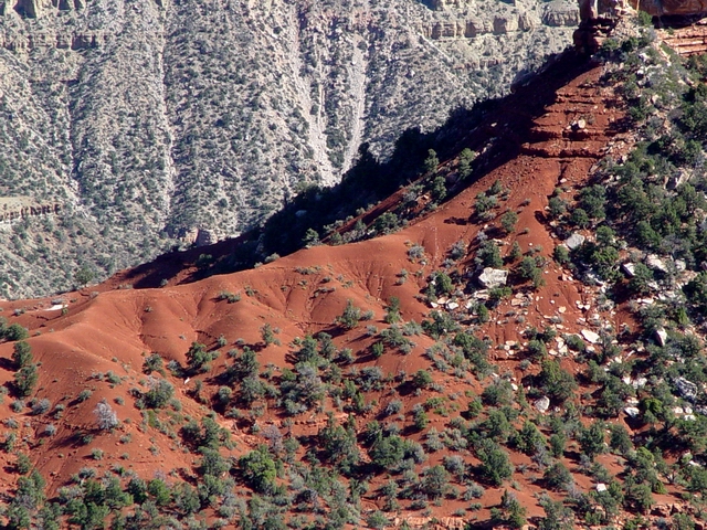
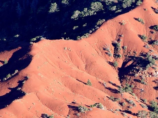
The
Kibbey Hermit (Leighty) The Permian Hermit Shale caps Kibbey Butte. The Hermit is distinctly reddish-colored and gullied in this area. The Hermit was originally deposited on an arid river flood plain during the late Early Permian (roughly 280 Ma). |
 |
Hancock
Butte (Leighty) Hancock Butte is capped by the Esplanade Sandstone, the uppermost formation of the Supai Group. The Esplanade is an eolian (wind deposited) sandstone much like the Coconino. The Esplanade is Early Permian in age (roughly 299 to 280 Ma), whereas the rest of the Supai Group is Middle to Late Pennsylvanian sandstone, mudstone, and limestone (roughly 313 to 299 Ma). The Redwall Limestone is the prominent cliff beneath the Supai. See PANORAMA. |
 |
Imperial
Fault (Leighty) The Imperial Fault (actually two small faults here) cuts through the saddle west of Hancock Butte. The fault on the left has roughly 20 feet of down-to-the-west displacement, whereas the fault on the right has about 15 feet of down-to-the-east displacement. |
 |
Supai
and Hermit at Hancock Butte (Leighty) Supai Group just north of Hancock Butte area. Note the distinctively eroded Hermit Shale capping the ridge. |
 |
Kaibab
along the rim (Leighty) Kaibab Formtion exposed along the canyon rim. |
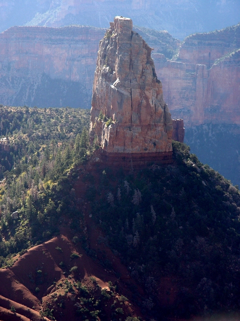 |
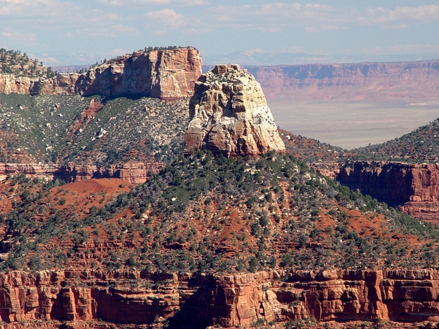
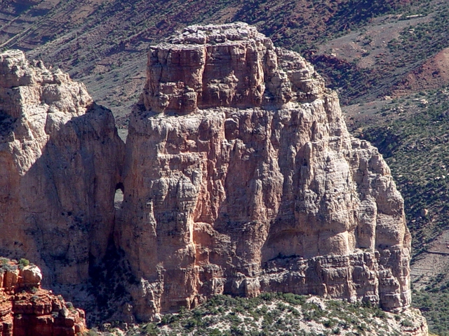
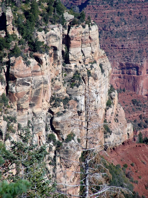
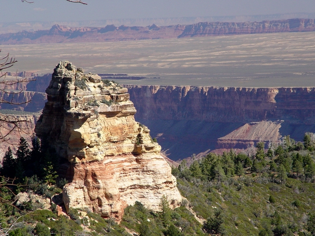
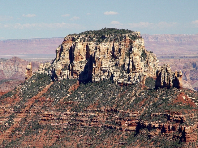
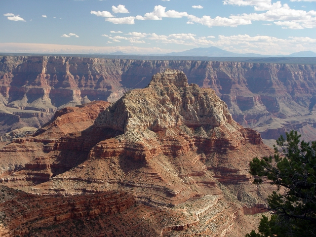
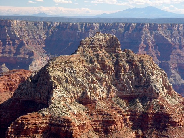
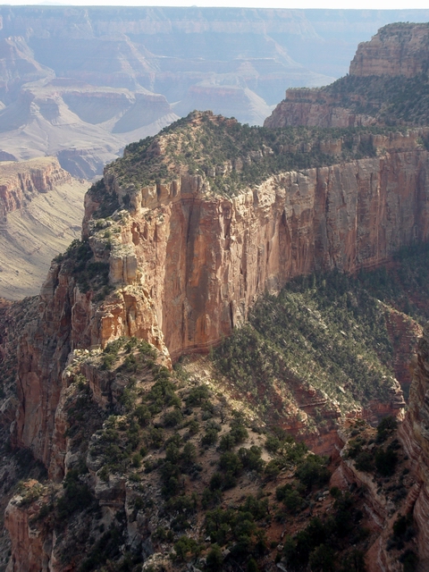
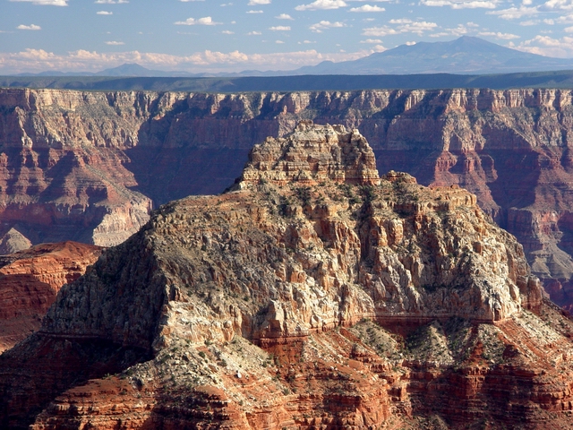
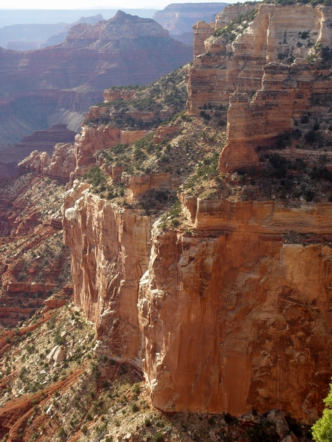
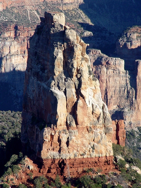
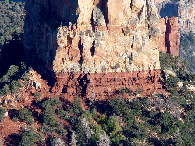
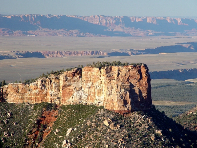
Mount
Hayden (Leighty) Morning view east of Mount Hayden, where light-colored, crossbedded Coconino Sandstone overlies reddish Hermit Shale. Elevation atop the butte is 8372 feet, roughly 400 feet above its base. This butte is named for Ferdinand Vandiveer Hayden, leader of the Hayden Survey of the American West, 1871-1878. |
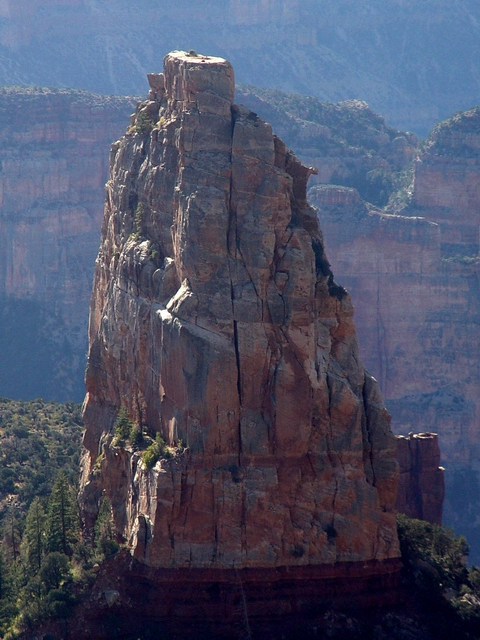 |
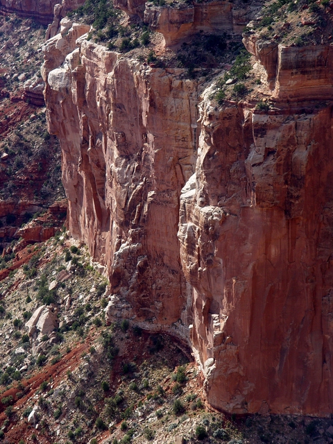
Mount
Hayden (Leighty) Close-up of the much-photographed, Coconino-capped butte. Several sets of crossbeds are exposed in the butte. The Coconino is typically a massive, cross bedded, cliff-forming unit in the Grand Canyon that likely represents a coastal sand dune complex. The Coconino underlies the Toroweap Formation and is late Early Permian in age (roughly 275 Ma). |
 |
Mount
Hayden and the Hermit (Leighty) Easily-eroded Hermit Shale underlies the Coconino Sandstone of Hayden Butte. Nankoweap Creek is visible is the distance. The Imperial Fault (roughly 20 feet down-to-the-east displacement) crosses from left to right at the bottom of the image. |
|
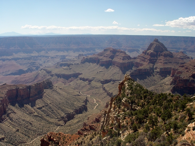
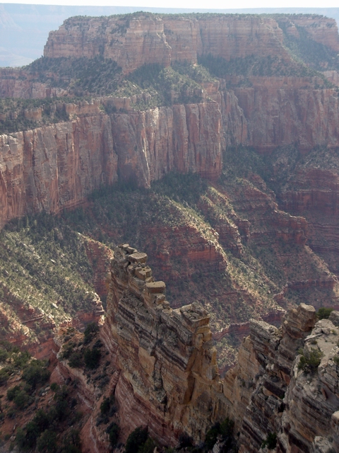
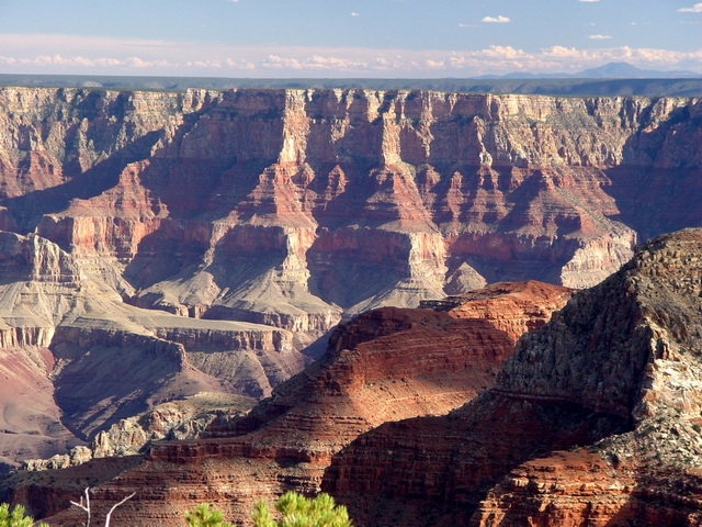
Vista Encantada |
|
 |
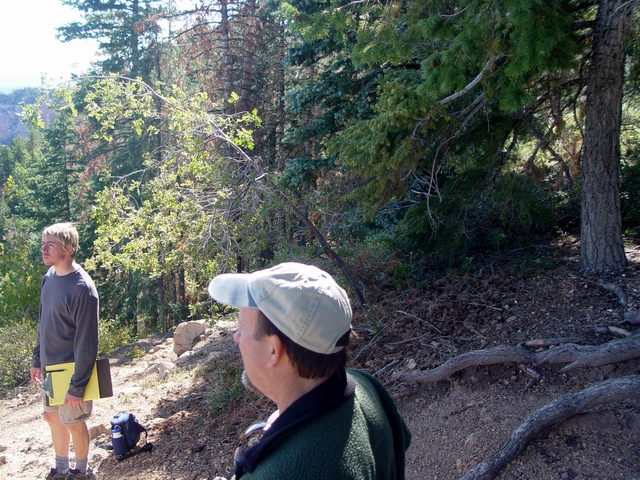
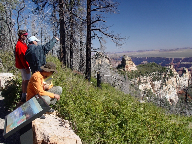
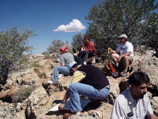
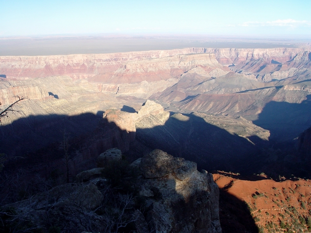
Another
great viewpoint (Leighty) The second stop on our way from Point Imperial to Cape Royal. Note the eastward tilt of the strata in the Boundary Ridge area (right skyline) - this is the upper portion of the East Kaibab monocline. Mount Hayden is the Coconino-capped butte to the left of Saddle Mountain (in the center of the image). Also note Marilyn dutifully carrying her yellow field guide. |
 |
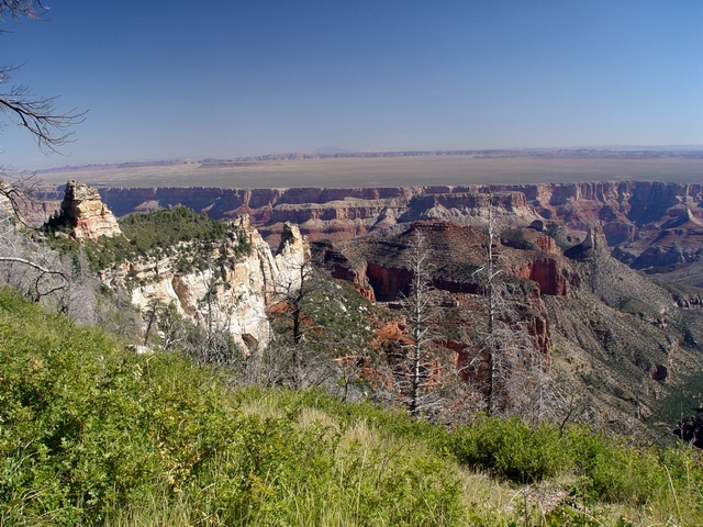
Brady
Peak (Leighty) View northeast toward Brady Peak (8107 feet elevation). Like Mount Hayden, Brady Peak is capped by Coconino Sandstone, which overlies the reddish, slope-forming Hermit Shale and thicker Supai Group. Again, note the East Kaibab monocline in the distance. The Echo Cliffs is the linear cliff in the distance. Navajo Mountain is also visible on the skyline. |
 |
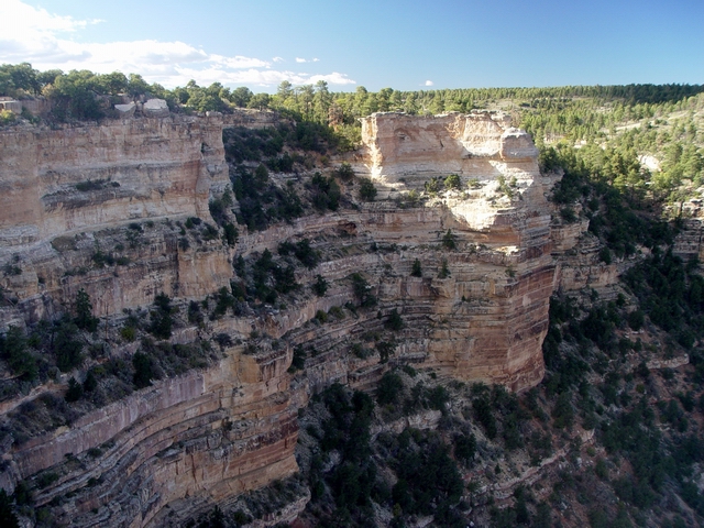
Big
monocline (Leighty) View northeast into one of the main drainages of Nankoweap Creek. The Kaibab Formation is exposed at this overlook, which has an elevation of roughly 8400 feet. The rim of the Grand Canyon seen to the east has an elevation of approximately 6000 feet and is capped by the same Kaibab Formation. Thus, the East Kaibab monocline folds the Kaibab Formation (and other formations) down over 2000 feet to the east. |
 |
Vista
Encantada (Leighty) Sonny, Ruediger, and Kurt enjoy the view. See PANORAMA. |
 |
Vista
Encantada (Leighty) Kurt and Rick enjoy the view. |
 |
View
north from Vista Encantada (Leighty) Mount Hayden is located in the middle of the image, with Point Imperial on skyline at left and Boundary Ridge on the skyline at right. |
 |
Mount
Hayden (Leighty) Close-up of the south side of Mount Hayden, about 4 kilometers north of Vista Encantada. |
 |
Brady
Peak (Leighty) Close-up of the south side of Brady Peak, named after an Arizona pioneer. See PANORAMA. |
 |
Hermit
ridge (Leighty) This southwest-trending ridge connecting Brady Peak with the Walhalla Plateau is capped by the Hermit Formation. |
 |
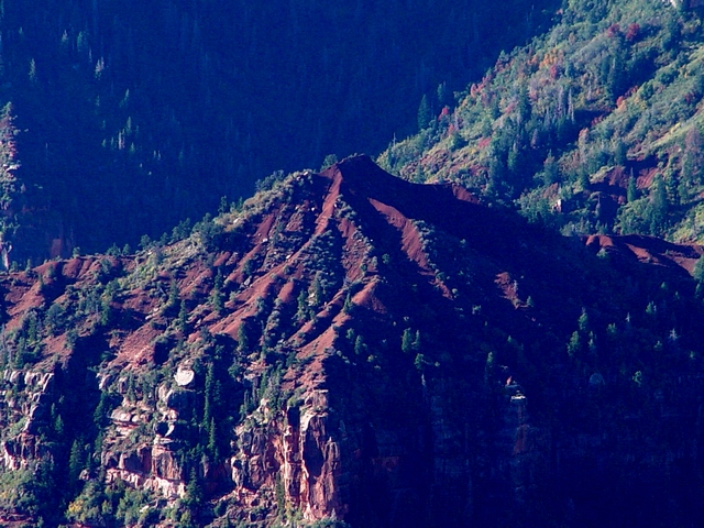
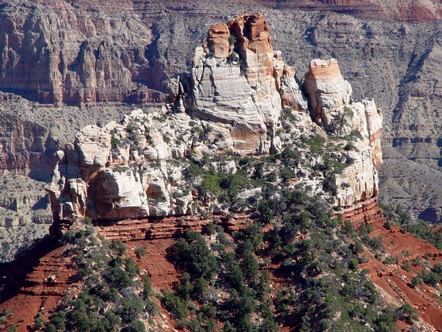
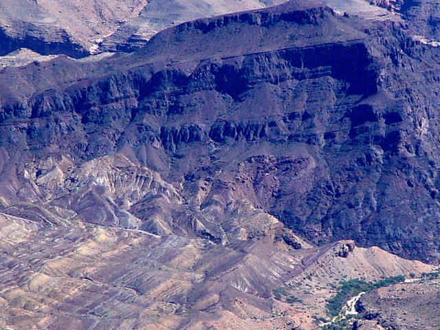
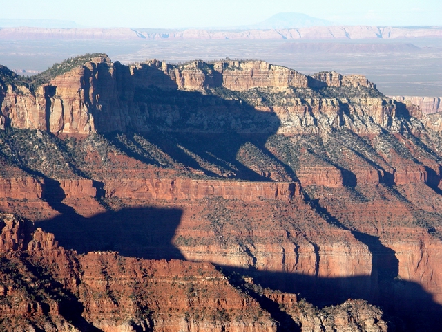
Not-so
red Redwall (Leighty) The Redwall Limestone is Early to Middle Mississippian in age (350 to 337 Ma), significantly older than the overlying Middle Pennsylvanian bottom of the Supai Group. This range of time spanning the Late Mississippian and Early Pennsylvanian likely witnessed uplift and erosion. The contact between these units represents this period, and is termed an unconformity (specifically, a disconformity). Note the arch located just southeast of Alsap Butte. |
 |
Half
& half Redwall (Leighty) This exposure of Redwall Limestone is just southeast of Hancock Butte. The western half has the reddish stain from the overlying Supai Group rocks, whereas the eastern half shows the true gray color of the Redwall Limestone. |
 |
Coconino
Sandstone cliffs (Leighty) View north along the rim. |
|
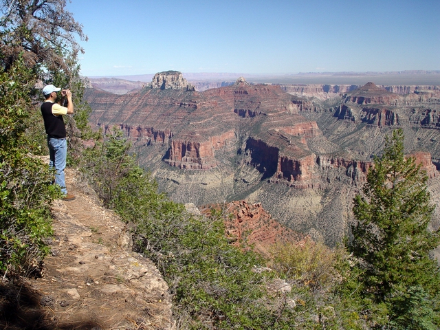
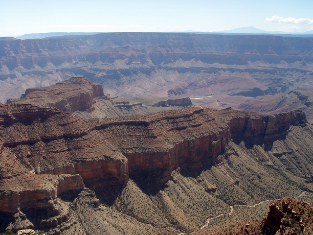
Point Roosevelt |
|
 |
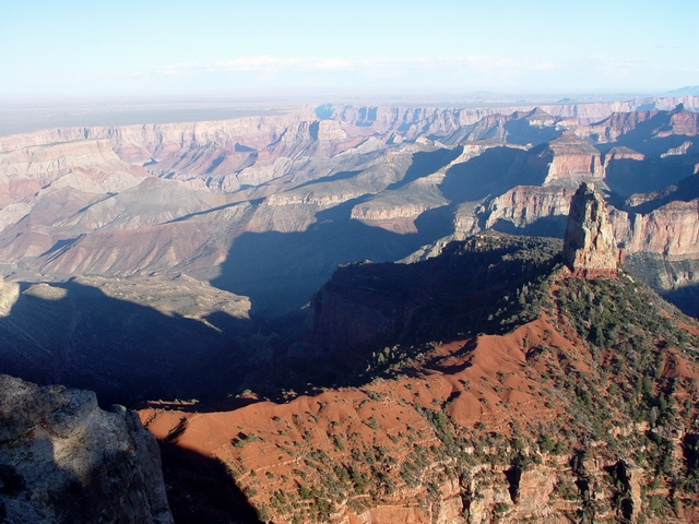
Presidential
view (Leighty) Todd, Sonny, and Miguel discuss the view at Point Roosevelt. See PANORAMA. |
 |
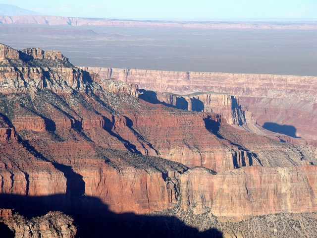
Tritle
Peak view (Leighty) Tritle Peak is the butte formed of Kaibab Limestone to the left. Colter Butte and Swillings Butte are farther northeast of Tritle Peak and are capped by Supai Group rocks. Hutton Butte is the prominent Redwall Limestone exposure farther to the northeast. Navajo Mountain is on the center skyline. Tritle Peak is named for F. A. Trittle, one of the first owners of the Jerome Copper mine and a former governor of Arizona in the 1880's. Hutton Butte is named for Oscar Hutton, a guide around who was killed by a mule who kicked him in the face. Colter Butte is named for James G. H. Colter, a desperado fighter, farmer, rancher, freighter. Swilling Butte is named for J. W. Swilling, who came to Arizona in 1859. |
 |
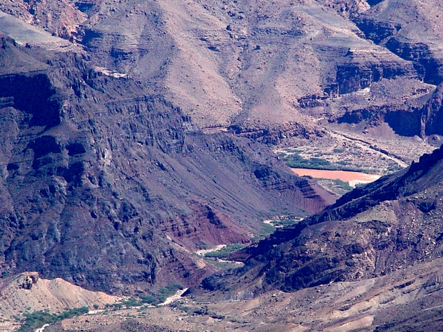
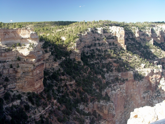
Upper
Kwagunt Creek (Leighty) View northeast down the Kwagunt Valley towards the Colorado River. An angular unconformity is exposed in the middle of the image where generally horizontal Cambrian sedimentary rocks overlie tilted rocks of the Late Proterozoic Grand Canyon Supergroup rocks. Kwagunt was the name of a Pai-Ute Indian who said he owned the valley. |
 |
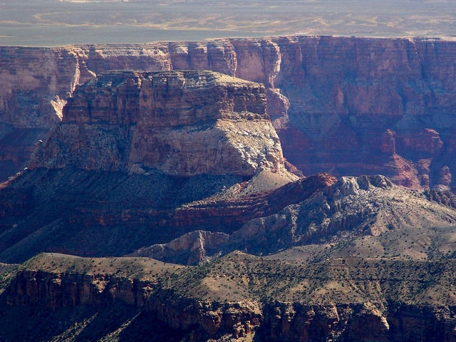
Atoko
Point (Leighty) Atoko Point (8400 feet elevation) looms above Kwagunt Valley. Gunther Castle (7199 feet elevation) is the butte in the distance to the left of Atoko Point. |
 |
Rim
view (Leighty) View south along the rim from the Point Roosevelt overlook. |
 |
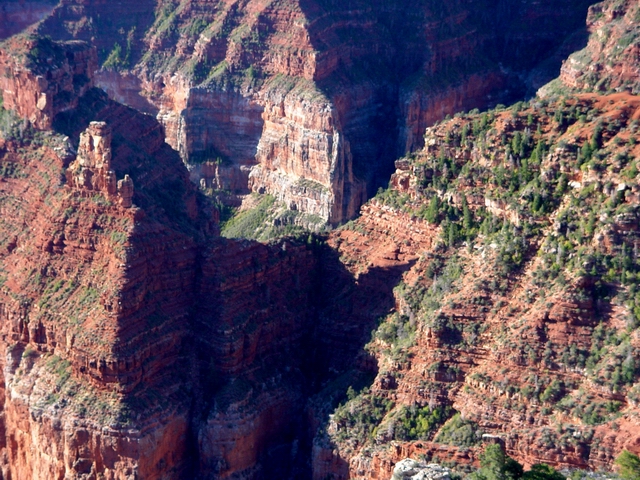
Butte
Fault at Kwagunt Butte (Leighty) These sedimenary layers were deformed by movement along the Butte Fault at Kwagunt Butte. The tilted red and gray layers are the Supai Group and Redwall Limestone, respectively. |
 |
Malgosa
Crest (Leighty) The Butte Fault also deforms strata just to the west of Malgosa Crest. |
 |
Tritle
Peak Kaibab (Leighty) A remnant of the Kaibab Formation forms Tritle Peak. Mesozoic rocks of the Echo Cliffs can be seen on the skyline. |
|
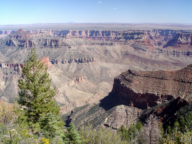
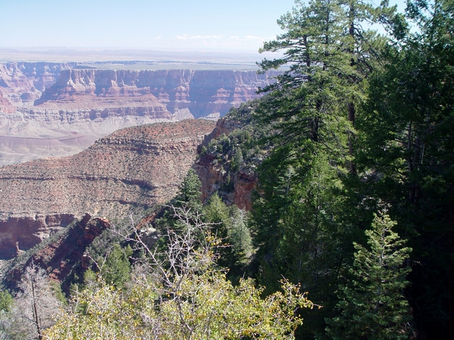
Cape Final Hike |
|
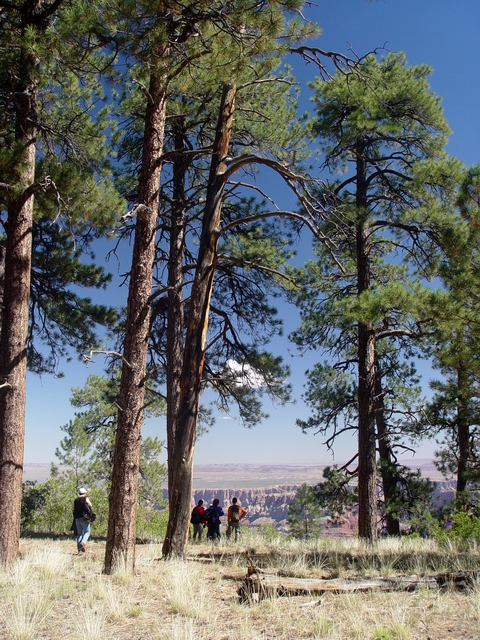 |
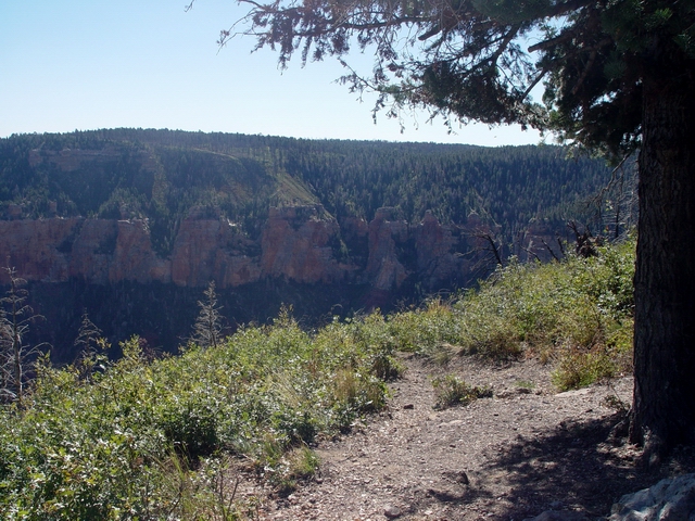
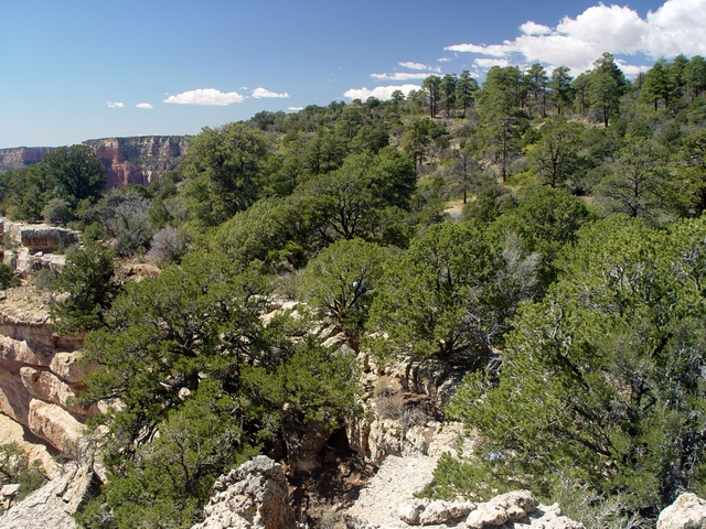
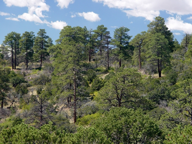
Ponderosa
pines along the trail (Leighty) The edge of the Ponderosa pine forest along the 8000-foot canyon rim. |
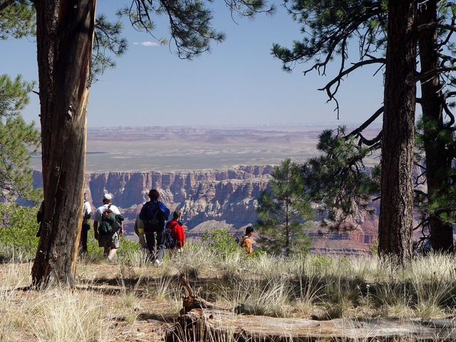 |
Rim
hikers (Leighty) The first view of the Canyon comes roughly two-thirds of the way along 2-mile trail to Cape Final. |
 |
Siegfried
Pyre (Leighty) A framed view north of Siegfried Pyre (elevation 7914 feet). |
 |
Upper
Lava Creek (Leighty) View north of the upper portion of the Lava Creek drainage. Siegfried Pyre, just left of center, has a thin layer of Toroweap Formation over the prominent Coconino cliffs. The Coconino-capped knob at center is unnamed. Gunther Castle (elevation 7199 feet) is the reddish-butte of Supai Group rocks farther right. The Vishnu Fault (up to 275 feet of down-to-the east displacement) trends up this drainage to the west of Siegfried Pyre. See PANORAMA. |
 |
Upper
Lava Creek (Leighty) View northeast down Lava Creek drainage. Navajo Mountain is on the center skyline. |
 |
Upper
Lava Creek (Leighty) View northeast down Lava Creek drainage. The gorge of the Little Colorado River is visible in the distance to the left. |
 |
Fault
trace (Leighty) Can you see the fault in this image? It has east-side-down displacement of roughly 50 feet. |
 |
Permian
Siegfried (Leighty) Capped by remains of the lower part of the Toroweap Formation, the remnant of Coconino Sandstone is what makes this butte prominent. The Hermit Shale and Supai Group lie below. Note the Vermillion Cliffs in the background. |
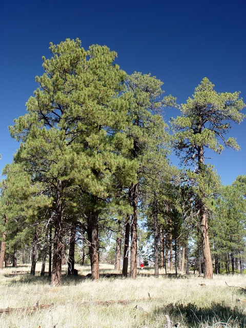 |
Ponderosa
pines along the trail (Leighty) Todd strolls throught the ubiquitous Ponderosa pines of the North Rim. |
 |
Downed trail ponderosa (Leighty) |
 |
Cape
Final rim view (Leighty) Looking N from Cape Final. |
 |
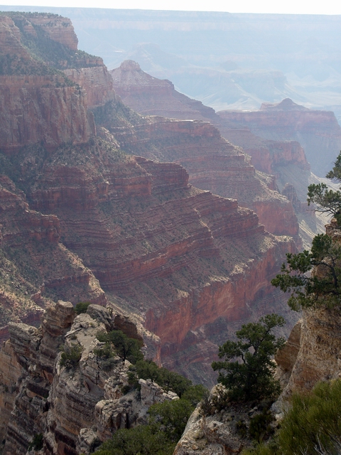
Kaibab
and Toroweap (Leighty) The distinctly bedded, cliff-forming Kaibab Formation is underlain by the tree-covered, slope-forming Toroweap Formation. |
 |
Cambrian
through Permian rocks (Leighty) Another view of the upper Lava Creek drainage in the Siegfried Pyre area. The Cambrian Muav Limestone forms most of the grayish cliffs and slopes beneath the massive Redwall Limestone cliffs. |
 |
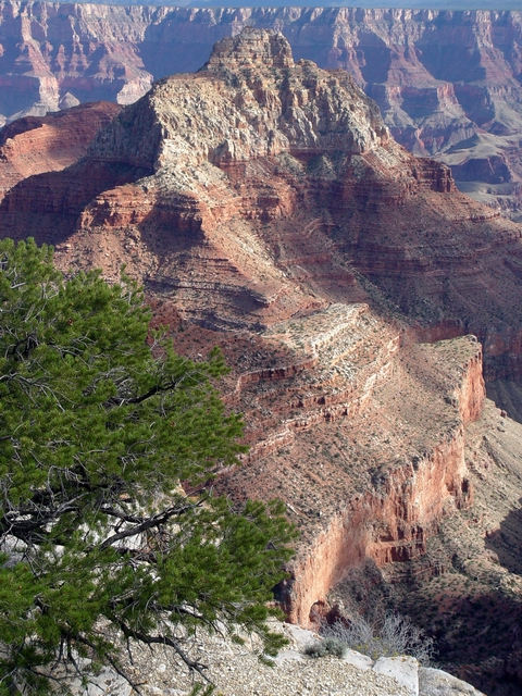
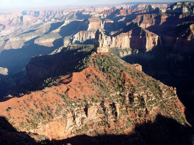
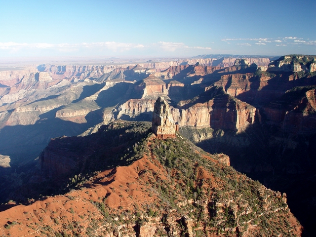
Cape
Final finally (Leighty) The forested edge of the Walhalla Plateau at Cape Final. See PANORAMA. |
 |
Vishnu
and Freya (Leighty) View southwest from Cape Final. Vishnu Temple (7529 feet elevation) is the prominent peak at left, with Freya Castle (7299 feet elevation) located near the center. |
 |
Upper
Unkar Creek (Leighty) View south of the Unkar Creek drainage. Rama Shrine (6411 feet elevation), capped by Supai Group and Hermit Formation rocks, is the lower ridge to the left of Vishnu Temple. A series of faults with down-to-the-east displacement (all <50 feet) trend NNE through the Vishnu Temple and Rama Shrine area (can you see where they are?). |
 |
Cape
Final finally (Leighty) View south towards Desert View on the South Rim. The San Francisco Peaks are on the skyline to the right. |
 |
Jupiter
Temple (Leighty) This butte (7081 feet elevation) is capped by a remnant of Coconino Sandstone. The "Palisades of the Desert" forms the large escarpment along the South Rim in the distance. Cedar Mountain is the flat-topped butte on the South Rim just right of center. |
 |
Cape
Final view (Leighty) View east from Cape Final. |
 |
Lower
Lava Creek (Leighty) |
 |
Crossbedding
at Jupiter Temple (Leighty) Note the crossbedding in the Coconino Sandstone. |
 |
South-trending
Coconino ridge (Leighty) View south toward Unkar Creek. |
 |
Surveyors
(Leighty) Todd and Rick survey the area south of Cape Final. |
 |
Kaibab
at Cape Final (Leighty) Layered rocks of the Kaibab Formation just south of Cape Final. |
 |
Chuar
Valley and Lava Chuar Hill (Leighty) Sedimentary rocks of the Middle to Late Proterozoic Chuar Group (950 to 825 Ma) are well exposed in Chuar Valley. The Chuar Group is over 5000 feet thick and is composed entirely of sedimentary rocks, including the Galeros and Kwagunt Formations. Dominating this view is the Carbon Canyon Member of the Galeros Formation, composed mostly of interbedded mudstone and carbonate layers. Older Cardenas Basalt forms most of Lava Chuar Hill. |
 |
Coconino
at Cape Final (Leighty) Massive Coconino cliff just north of Cape Final. |
 |
Carbon
Canyon gorge (Leighty) Carbon Creek cuts through the Cambrian Tapeats Sandstone. The Tapeats is a nearshore marine sandstone that is Late Early Cambrian to Middle Cambrian in age (520 to 501 Ma). It represents a shallow Cambrian ocean that once covered much of southwestern North America. The layered rocks of the Carbon Canyon Member of the Galeros Formation are in the foreground. See PANORAMA. |
 |
Palisades
fault (Leighty) The north-side-down Palisades Fault juxtaposes the Cambrian Tapeats Sandstone against the dark-colored Cardenas Basalt of Lava Chuar Hill. Another fault exposed here is the north-trending Butte Fault, the major fault associated with the East Kaibab monocline. It crosses from left-to-right in this image between the layered sedimentary rocks of the Galeros Formation and the dark-colored Cardenas Basalt. |
 |
Cardenas
Lavas of Lava Chuar Hill (Leighty) The Cardenas Basalt, which consists of mostly lava flows in the eastern Grand Canyon and mostly intrusions (sills and dikes) to the west, is mostly Middle Proterozoic in age (1100-950 Ma). This unit is named after Don Garcia Lopez de Cardenas, who in 1540, led a Spanish expedition to the Grand Canyon area, as part of Coronado's search for the fabled Seven Cities of Cibola. |
 |
Lower
Lava Creek (Leighty) The Cardenas Basalt overlies the reddish upper part of the Middle Proterozoic Dox Formation (1250-1100 Ma). It is hard to directly date some Proterozoic sedimentary units (like the Dox Formation) because of the lack of fossils. Lava Creek drains into the Colorado River here, forming Lava Canyon rapid (a relatively small rapid with a 4-foot drop). |
 |
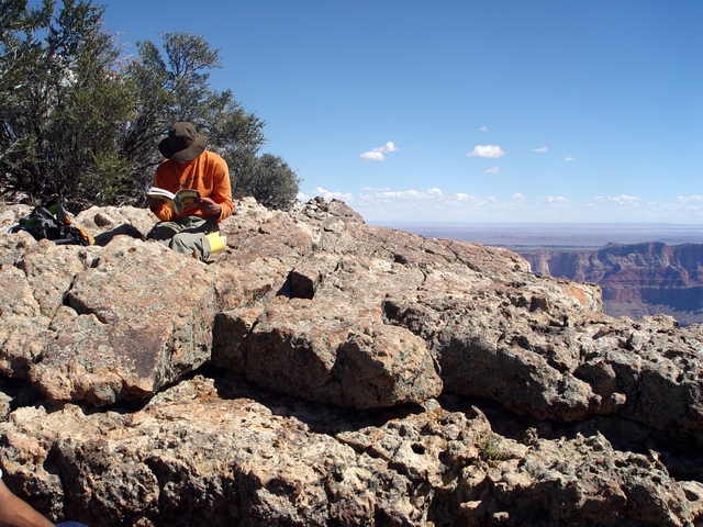
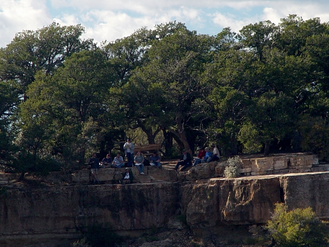
Cape
Final lunch (Leighty) Heather, Sonny, Donna, Rick, and Humberto having lunch on the Kaibab. See PANORAMA. |
 |
Lunch
with a view (Leighty) |
 |
Kaibab
cliffs (Leighty) View to the south from the lunch spot. |
 |
Forested
rim at Cape Final (Leighty) View to the west from the lunch spot. |
 |
Kaibab
bedding (Leighty) View to the north from the lunch spot. |
 |
Unkar
Creek Bright Angel and Tapeats (Leighty) View south of Unkar Creek where the slope-forming Bright Angel Shale confomably overlies the cliff-forming Tapeats Sandstone. The Bright Angel is Late Early Cambrian to Middle Cambrian in age (520 to 501 Ma). There is no significant time difference between this unit and the overlying Muav nor the overlying Tapeats (the contact between the two units is conformable). Like the Muav and Tapeats, the Bright Angel is a shallow marine unit. |
 |
Tapeats
cliffs (Leighty) The resistent Tapeats Sandstone typically forms cliffs and narrows. See PANORAMA. |
 |
Unconformity
(Leighty) The Cambrian Tapeats Sandstone in this area unconformably overlies much older Cardenas Basalt and Dox Formation (t he Dox is 600-750 Ma older than the Tapeats). The rocks representing this over 1/2 billion year period are missing, and the contact between the Tapeats and the older rocks are known as "the Great Unconformity". |
 |
Unkar
Creek Bright Angel (Leighty) Unkar Creek flows through the Bright Angel Shale just above the Tapeats narrows. |
 |
Venus
and Apollo (Leighty) Venus Temple (to the left) and Apollo Temple (to the right) are both capped by the Supai Group. |
 |
Dr. X at Cape Final (Leighty) |
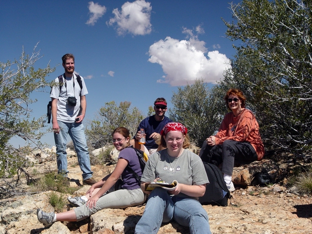 |
Lunch
crowd (Leighty)
Patrick, Jenn, Todd, Heather, and Donna. |
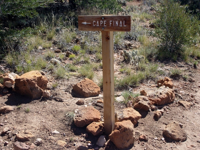 |
Cape Final trail sign (Leighty) |
 |
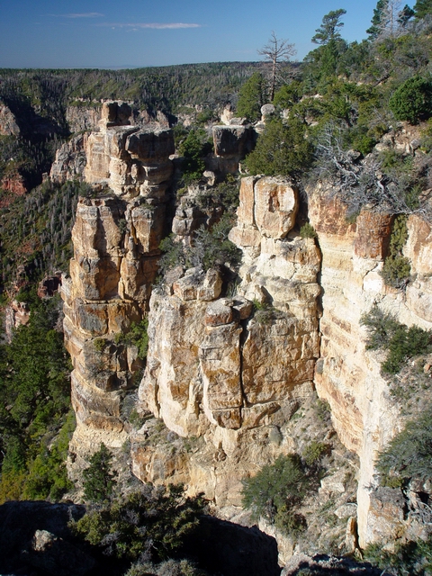
Kaibab
"diving board" (Leighty) This outcrop is located just north of Cape Final. |
 |
Kaibab
ledge (Leighty) View northeast with Gunther Castle visible to the right. |
|
Cape Royal |
|
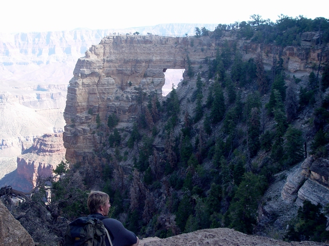 |
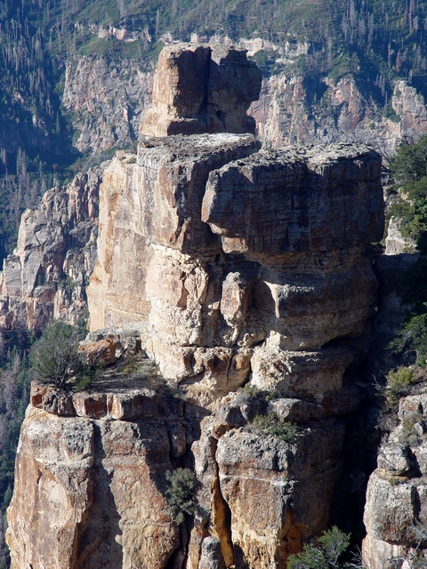
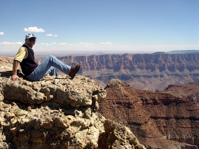
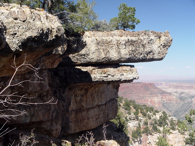
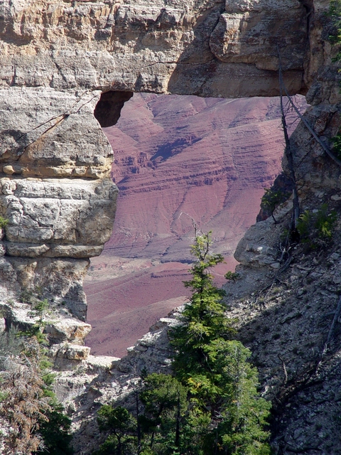
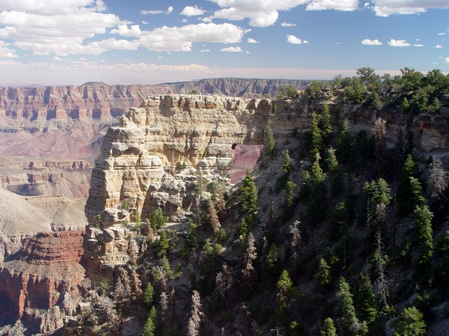
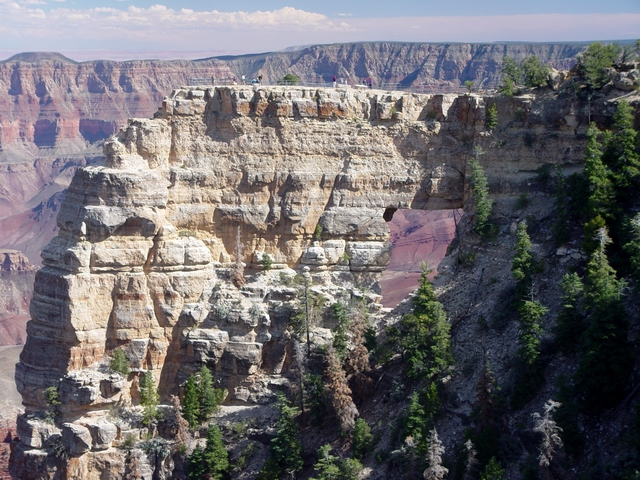
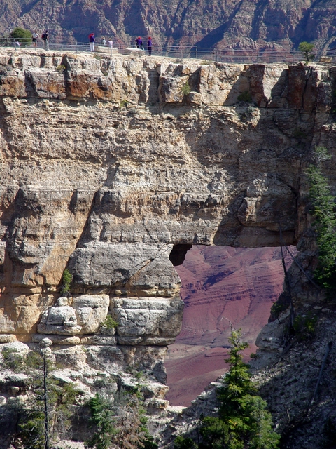
Angel's
Window (Leighty) One of the cool attractions at Cape Royal. Cape Royal was formerly called Greenland Point. |
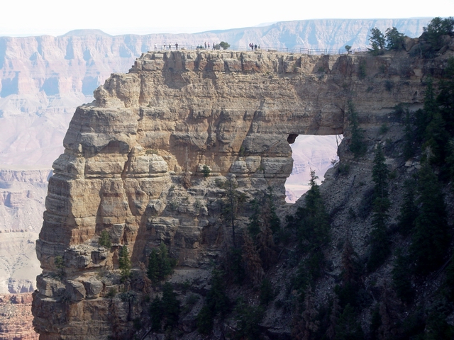 |
Kaibab
arch (Leighty) This arch is formed in the Permian Kaibab Formation. |
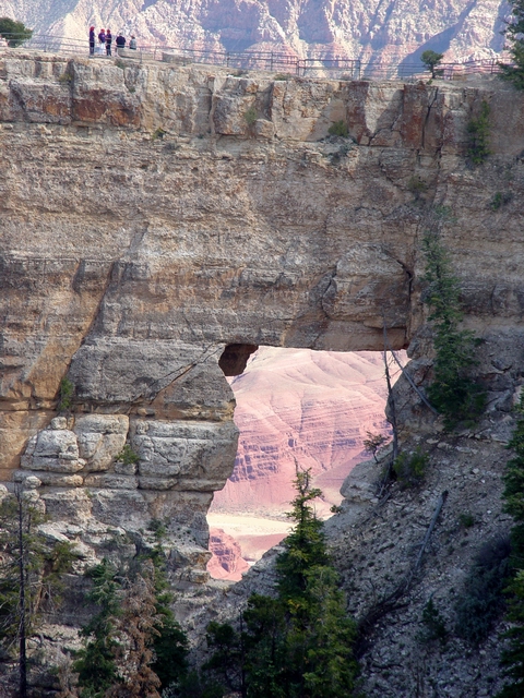 |
Big
window (Leighty) The window is roughly 60 feet high. Note the overlook on top with people for scale. Also note the multiple fractures in the arch (not the most stable situation). You can see the Colorado River through the window. |
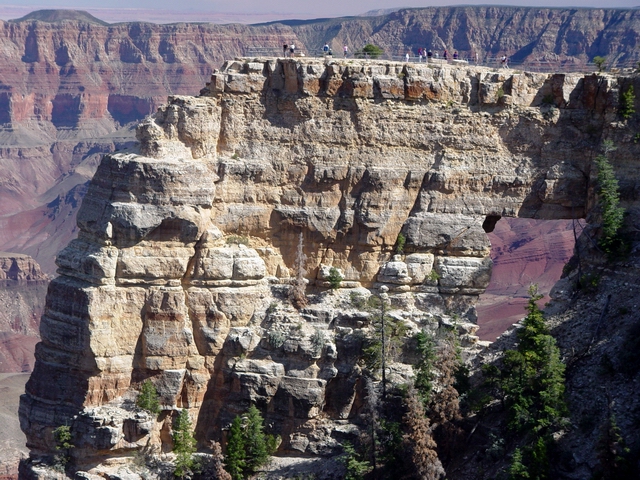 |
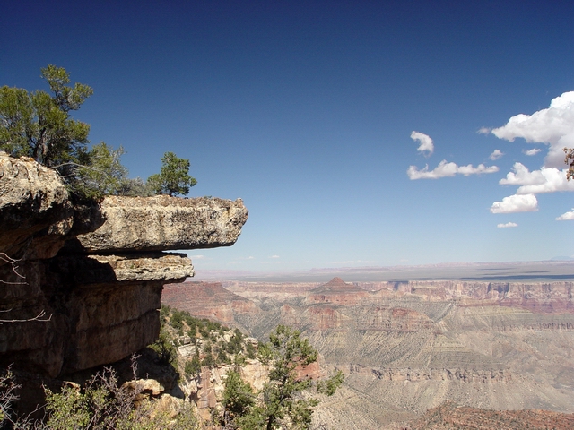
Angel's
view (Leighty) Distinctive bedding in the Kaibab. View southeast shows the South Rim skyline, with Cedar Mountain on the left and Desert View on the right. |
 |
Dox
through the Window (Leighty) Another view through the window showing the Middle Proterozoic Dox Formation in the distance. |
 |
Angel's Window (Leighty) |
 |
The
angel and the monocline (Leighty) The East Kaibab monocline can be seen in the South Rim in the distance where the layers at Desert View (center skyline) are higher than the layers beneath Cedar Mountain (left skyline). |
 |
Angel's Window (Leighty) |
 |
Angel's Window (Leighty) |
 |
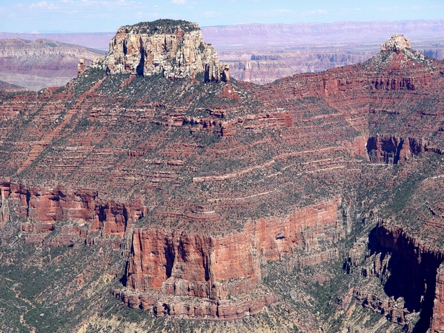
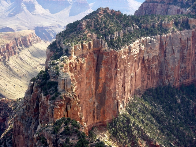
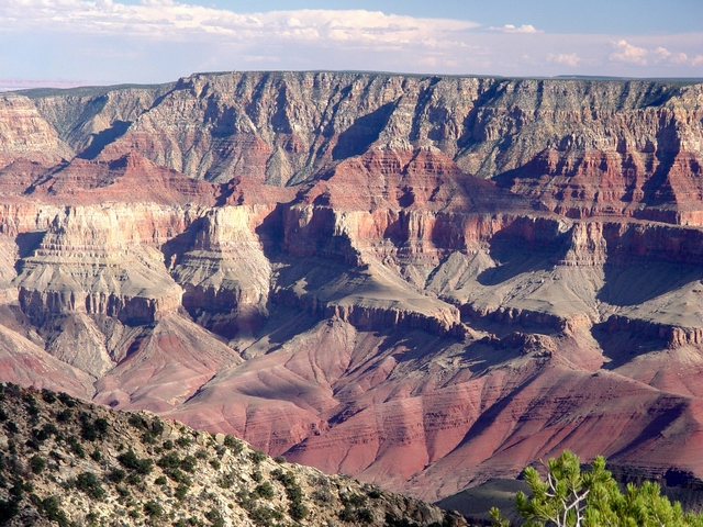
Vishnu
Temple (Leighty) This Kaibab-capped butte (7529 feet elevation) south of Cape Royal is one of the most visible landmarks in the eastern Grand Canyon area. The southeast-side-down Vishnu fault trends from left to right foreground. Note the volcanic mountains of the San Francisco volcanic field on the skyline (from left to right: O'Leary Peak, San Francisco Mountain, and Kendrick Peak). Within the Hindu trinity of Brahma, Vishnu, and Shiva, the four-armed Vishnu is considered to be the preserver of the universe. |
 |
Vishnu
Temple (Leighty) Kaibab through Supai is visible here at Vishnu Temple. The rough texture of the Coconino Sandstone is due to weathering and erosion of its cross bedding. O'Leary Peak and San Francisco Mountain are visible on the skyline. Sugarloaf Mountain is the small "bump" on the left flank of San Francisco Mountain. |
 |
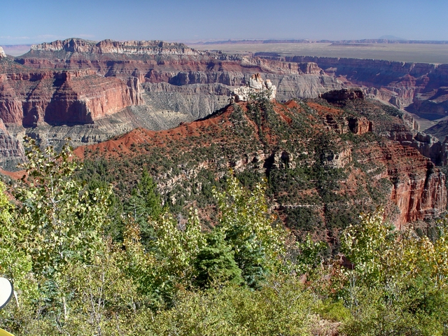
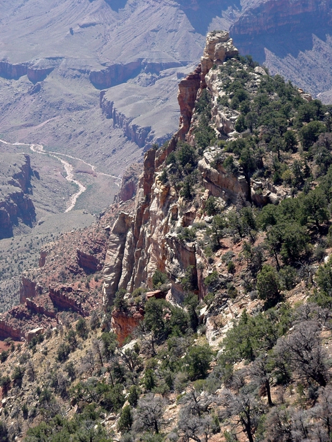
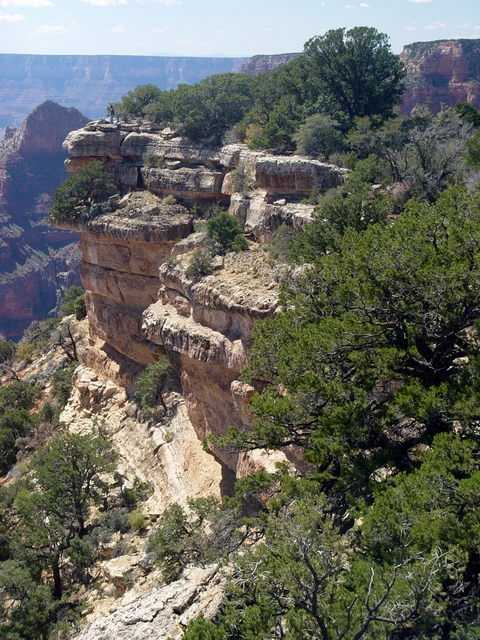
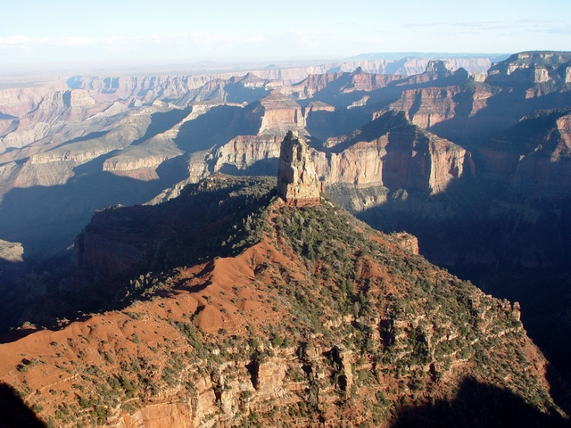
Coconino
cliffs (Leighty) A massive cliff of Coconino Sandstone forms the northeastern ridge that connects Cape Royal (7865 feet elevation) with Wotans Throne (~7700 feet elevation). |
 |
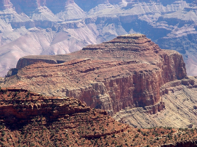
Wotans
Throne (Leighty) View southwest of Wotans Throne. Kaibab through Redwall is seen here. This feature is named for the supreme Teutonic god, a counterpart of the Norse god Odin. |
 |
Kaibab
wall (Leighty) A fin of Kaibab Formation projects to the southwest from Cape Royal. |
 |
Vishnu
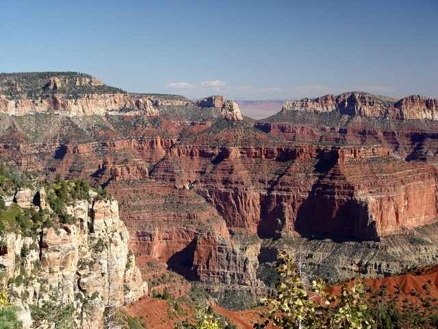
Temple (Leighty) View south of the Vishnu Temple area. See PANORAMA. |
 |
Krishna
Shrine (Leighty) View toward Krishna Shrine. This north-trending tributary of Vishnu Creek is formed by several faults that pass through the saddle between Krishna Shrine and Vishnu Temple. Coronado Butte (7108 feet elevation) is visible in the distance. Krishna Shrine is named after the eighth incarnation of the Hindu god Vishnu. |
 |
Coconino
and Toroweap (Leighty) The northeastern ridge that connects Cape Royal with Wotans Throne. It is formed mostly of the highly resistant Coconino Sandstone and capped by the slope-forming Toroweap Formation. The small cliff near the bottom of the Toroweap is formed by resistant dolomite of the Brady Canyon Member, whereas the tree-covered slopes above are formed by the Woods Ranch Member. |
 |
Wotans
Throne (Leighty) View southwest of Wotans Throne. |
 |
Wotans
Throne (Leighty) View west down one of the tributaries of Clear Creek. The Redwall Limestone forms the large cliff near the bottom of Wotans Throne. Part of Angels Gate can be seen behind Wotans Throne. The Howlands Butte is the small butte in the distance on the right. |
 |
Horseshoe
Mesa (Leighty) View south across the Canyon of Horseshoe Mesa. The Grandview Trail is located here and connects with the Tonto Trail to provide access to the Colorado River. |
 |
Vishnu
Temple (Leighty) View south from Cape Royal of the Vishnu Temple area. O'Leary Peak and San Francisco Mountain are visible on the skyline. See PANORAMA. |
 |
Rama
Shrine (Leighty) Rama Shrine (6411 feet elevation) is the butte at center-right capped by reddish Hermit Shale. Rama Shrine is named for the Hindu god Rama, who is known as an ideal man and hero of the epic Ramayana. |
 |
Lipan
Point (Leighty) Lipan Point is in the center of this view of the South Rim. The Great Unconformity in this view is the angular unconformity between the tilted Middle Proterozoic Dox Formation and the flat-lying Cambrian Tapeats Sandstone. The Tanner Trail starts at Lipan Point and is another major Rim-to-River route in the eastern Grand Canyon. |
 |
Desert
View (Leighty) |
 |
Desert
View and Cedar Mountain (Leighty) Tilted layers of Middle Proterozoic Cardenas Basalt and Dox Formation underliemore flat-lying Paleozoic rocks, forming the Great Unconformity here. The Desert View Watchtower is visible on the Rim edge to the right. Cedar Mountain (elevation 7053 feet) is the flat-topped butte on skyline left, and is one of the few remaining remnants along the South Rim of Triassic rocks. Cardenas Creek forms a small delta (river mile 71) in the Colorado River at bottom left. |
 |
Palisades
of the Desert (Leighty) The prominent escarpment northeast of Desert View is known as the Palisades of the Desert. Cedar Mountain is underlain by the Triassic Moenkopi Formation and is capped by the more resistant Shinarump Conglomerate of the Chinle Formation. Shadow Mountain, a Pleistocene cinder cone, is the dark-colored hill in the distance to the left of Cedar Mountain. |
 |
Permian
cliffs of Cape Royal (Leighty) A view of the Kaibab through Hermit section directly west of Cape Royal. Brahma Temple is the large butte in the distance. See PANORAMA. |
 |
Massive
Coconino cliff (Leighty) The shear Coconino cliffs directly west of Cape Royal. |
 |
Toroweap
slopes (Leighty) Slope-forming Toroweap Formation directly west of Cape Royal. Brahma Temple is the large butte in the distance. |
 |
Kaibab
and Toroweap (Leighty) The Kaibab and Toroweap Formations directly west of Cape Royal. |
 |
Coconino cliff (Leighty) More shear cliffs directly west of Cape Royal. |
 |
Atop
Angel's Window (Leighty) Todd, Donna, and Jeff brave the dizzying height atop the Angel's Window arch. |
 |
Our
group sketching the window (Leighty) From left to right, Kurt, Jenn, Patrick, Amanda, Heather, Heidi, Ruediger, Marilyn, and Humberto. |
 |
Cape
Royal cliffs (Leighty) View north from atop Angel's Window of the southern edge of the North Rim at Cape Royal. See PANORAMA. |
 |
Cape
Royal cliffs (Leighty) View north from atop Angel's Window of the southern edge of the North Rim at Cape Royal. |
 |
Cape
Royal cliffs (Leighty) View northeast from atop Angel's Window of the southern edge of the North Rim at Cape Royal. |
 |
Cape
Royal cliffs (Leighty) View northeast from atop Angel's Window of the southern edge of the North Rim at Cape Royal. |
 |
Unkar
Rapid area (Leighty) View southeast of the Unkar Rapid (river mile 72.5; 25-foot drop), formed by the large debris fan from Unkar Creek. The Dox Formation forms the reddish cliffs . There are numerous Anasazi Indian ruins in this area. |
|
Point Imperial Sunset |
|
 |
Point
Imperial vista (Leighty) Late afternoon view east from Point Imperial. |
 |
Point
Imperial vista (Leighty) Late afternoon view east from Point Imperial. |
 |
Mount
Hayden (Leighty) Coconino Sandstone and Hermit Shale of Mount Hayden. |
 |
Mount
Hayden (Leighty) |
 |
Late
afternoon Imperial vista (Leighty) View of the Nankoweap Creek area. See PANORAMA. |
 |
Late
afternoon Imperial vista (Leighty) View of the Nankoweap Creek area. |
 |
Late
afternoon Imperial vista (Leighty) View of the Nankoweap Creek area. |
 |
Late
afternoon Imperial vista (Leighty) View of the Nankoweap Creek area. |
 |
Hermit-Coconino contact (Leighty) |
 |
Hermit
of Mount Hayden (Leighty) A view of the Hermit-capped ridge connecting Point Imperial with Mount Hayden. |
 |
Boundary Ridge (Leighty) View north from Point Imperial of the ridge that forms the boundary of the Grand Canyon National Park in this area. See PANORAMA. |
 |
Boundary
Ridge (Leighty) View north from Point Imperial of the ridge that forms the boundary of the Grand Canyon National Park in this area. |
 |
Boundary
Ridge (Leighty) View north from Point Imperial of the ridge (which includes Saddle Mountain) that forms the boundary of the Grand Canyon National Park in this area. |
 |
Boundary
Ridge (Leighty) View northeast from Point Imperial of the ridge (which includes Saddle Mountain) that forms the boundary of the Grand Canyon National Park in this area. |
 |
Boundary
Ridge (Leighty) View northeast from Point Imperialof the ridge that forms the boundary of the Grand Canyon National Park in this area. |
 |
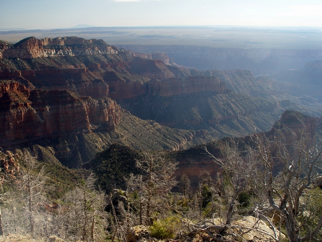
Little
Colorado River gorge (Leighty) View southeast of the confluence of the Colorado and Little Colorado Rivers. |
 |
Imperial
view north (Leighty) View north from Point Imperial over Boundary Ridge toward Marble Canyon and the Vermillion Cliffs. See PANORAMA. |
 |
Imperial
view north (Leighty) View north from Point Imperial over Boundary Ridge toward Marble Canyon and the Vermillion Cliffs. |
 |
Imperial
view north (Leighty) View north from Point Imperial over Boundary Ridge toward Marble Canyon and the Vermillion Cliffs. |
 |
Navajo Mountain (Leighty) |
 |
Another
Imperial view north (Leighty) View north from Point Imperial over Boundary Ridge toward Marble Canyon and the Vermillion Cliffs. See PANORAMA. |
 |
Another
Imperial view north (Leighty) View north from Point Imperial over Boundary Ridge toward Marble Canyon and the Vermillion Cliffs. |
|
Camp |
|
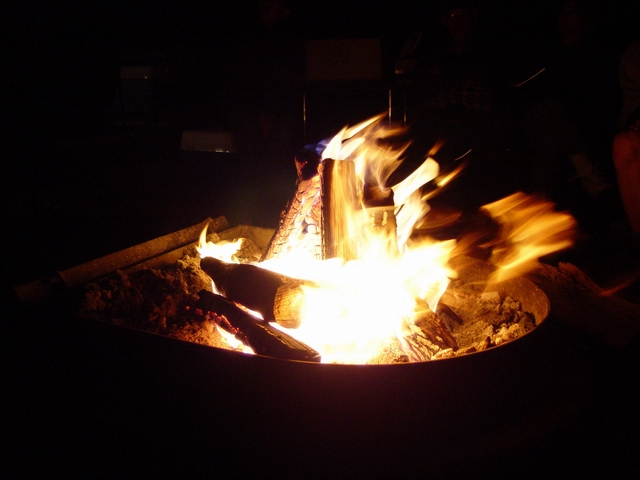 |
Campfire,
day 2 (Leighty) See VIDEO. |
 |
Campfire close-up (Leighty) |
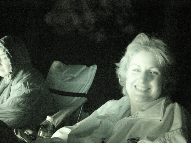 |
Campfire
critters (Leighty) Heidi and Donna. See PANORAMA. See VIDEO. |
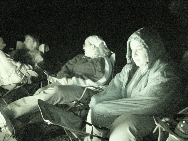 |
Campfire
critters (Leighty) Kurt, Heather, and Heidi. |
 |
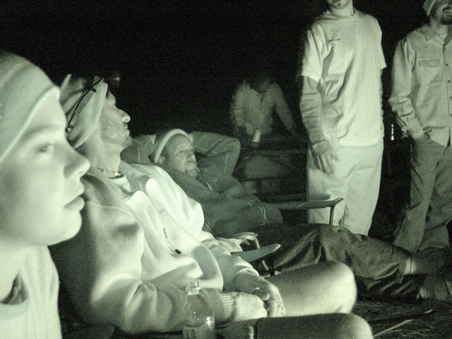
Campfire
critters (Leighty) Mary, Jodi, Kurt, and Heather. |
 |
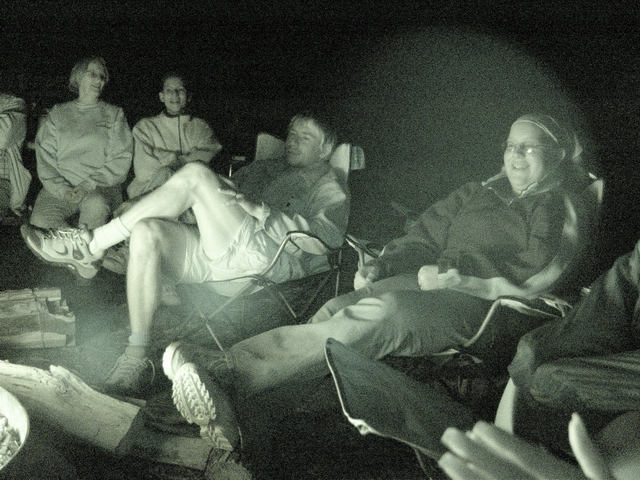
Campfire
critters (Leighty) Miguel, Humberto, Marilyn, and Patrick. See PANORAMA. |
 |
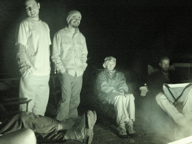
Campfire
critters (Leighty) Jenn, Todd, Rick, Jeff, Miguel, and Humberto. See VIDEO. |
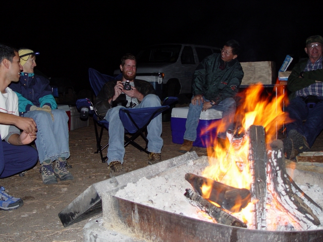 |
Campfire
critters in color (Leighty) Miguel, Marilyn, Patrick, Sonny, and Ruediger. |
 |
Humberto lurks by the fire (Leighty) |
| Previous day | Day
2 |