Part A
Landscapes of America
From the Atlantic to the Pacific, the United States contains a remarkable diversity of landscape and geologic features that record much of its natural history. The shape of the landscape (or physiography) is largely due to the underlying geology, although other factors are also important (e.g., climate, vegetation, etc.). Before we explore the geologic features of the U.S.A., it is important to review and understand the basics of its physiography.
|
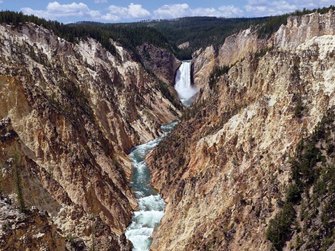
Figure 11-2. Amerca's diverse geologic landscapes range from coastal plains and shorelines to rugged mountainous areas. At left, the Grand Canyon of the Yellowstone (USGS/YVO/S.R. Brantley). At right, the sandy beaches of the South Carolina coast. |
|
Physiographic Regions
Let's first look at the landscape of the U.S.A. Before we look at a few areas in detail, let's get familiar with the regional physiography and geology across the United States. A Tapestry of Time and Terrain (USGS Geologic Investigations Series I-2720) is a map and illustrated pamphlet that describes the physiography and geology of the United States. This pamphlet includes a list of physiographic areas (page 10), descriptions of specific features (pages 5-9), and various maps (pages 12-15). The physiographic provinces are the numbered areas and the sections are lettered.
Answer Quiz Me! questions A01 through A15 using the A Tapestry of Time and Terrain pamphlet (see the PDF link below). If necessary, refer to the Sedimentary Rock Identification Chart (see PDF HERE).
|
A Tapestry of Time and Terrain pamphlet |
![]()
![]()
![]()
![]()
![]()
![]()
![]()
![]()
![]()
![]()
![]()
![]()
![]()
![]()
![]()

