Part D
Geology of the Grand Canyon's Inner Gorge
Deep within the Grand Canyon, exposed along the Colorado River and some its tributaries, lies the Inner Gorge. The geology can be complex and includes a diverse suite of Proterozoic igneous, sedimentary, and metamorphic rocks. It is alsohome to Arizona's oldest rocks. Time to explore the Inner Gorge of the Grand Canyon and solve some of its geologic mysteries!
|
|
|
|
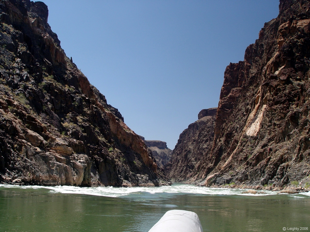
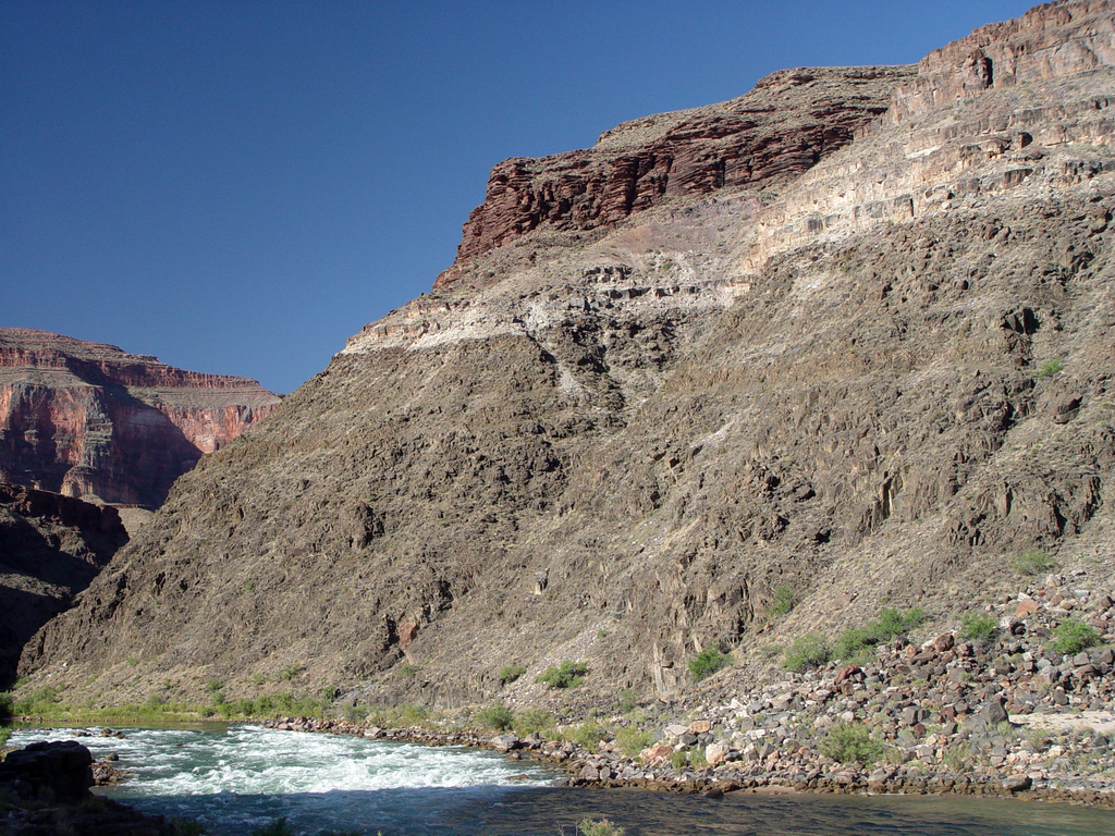
Figure 9-8. Proterozoic rocks of the Inner Gorge of the Grand Canyon. At left, the river corridor narrows at Grapevine Rapid (river mile 81.4), located where Grapevine Creek and Vishnu Creek enter the Colorado River. |
|
Inner Gorge Sequence Diagram
|
|
|
Figure 9-9. A sequence diagram for the Inner Gorge area. Click HERE for a printable PDF version. |
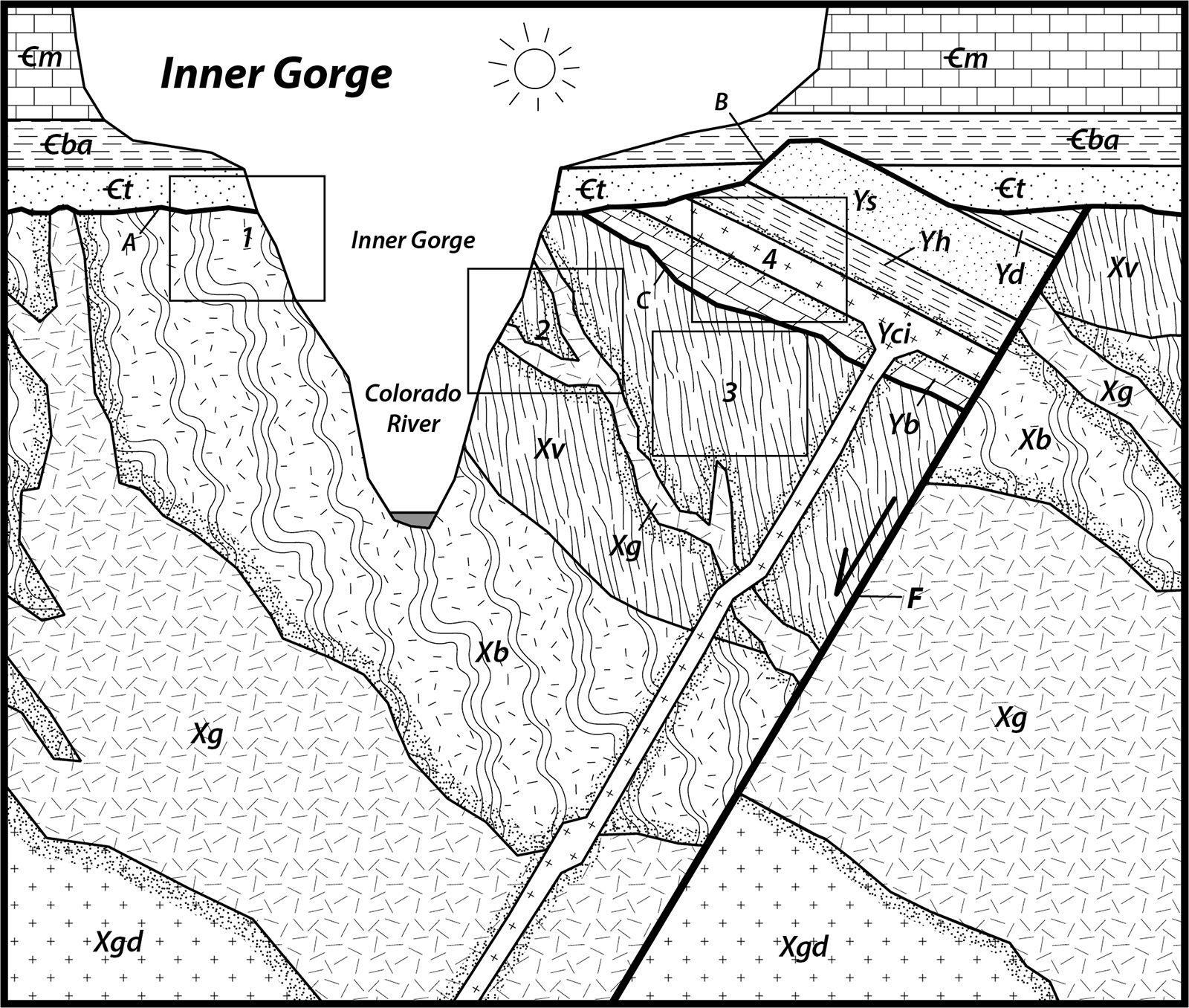
Refer to the Inner Gorge sequence diagram (Figure 9-9) to answer Quiz Me! questions D44 through D50. If necessary, print a hard-copy of the diagram. Also refer to the Key to Map Fill Patterns (see PDF HERE).

Recognizing Geologic Features in Landscapes
The ability to recognize rock units and features in a landscape is a fundamental skill in field geology. It is like recognizing landscape features using a topo map, except this is about the geology. Here are a few observational tips for Grand Canyon area rocks:
sedimentary rocks - often show layering of different thicknesses
sandstone and limestone - form cliffs
lava flows - form step-like cliffs, commonly with vertical joints
mudstone / evaporite - forms slopes
metamorphic rocks (+/- plutonic igneous rocks) - typically form massive, jagged slopes or cliffs
intrusions - dikes are easy to spot, but sills may be harder (they may look like sedimentary layers)
angular unconformities - look for the angular difference between layered rocks above and below
nonconformities - look for layered rocks above the boundary with more massive rock below
disconformities - hard to tell from a distance (it is a boundary between layered rocks stacked on layered rocks)
faults - look for linear trends and offset units or features
Now, let's use these tips to match the boxed locations on the Inner Gorge sequence diagram (Figure 9-9) with some landscape images.
In the boxed area of the sequence diagram, try to:
> identify the rock types (using the fill pattern key)
> identify the units (using the unit symbols) - this isn't always necessary
In the landscape image, try to do one or more of these:
> delineate the main rock layers
> interpret what rock types they represent by observing the type of landscape they form (cliffs vs. slopes)
> identify what rock units they represent using their stratigraphic position
After finishing this lesson, complete the form below: