Part D
Geology of Incendium Terra
The history of the early Earth is shrouded in mystery. However, the geologic events of Earth's early days may have been shared by the other planetary bodies in our Solar System, including our Moon and Mars (see Figure 8-11). We have interpreted their geologic histories largely by looking at a map view of their surfaces (instead of using cross sections). Let's review how we can use a few simple concepts to decipher the geologic history of a planetary surface.
|
|
|
|
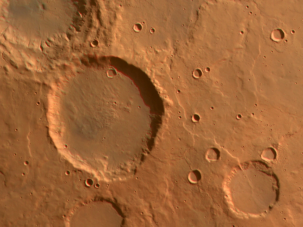
Figure 8-11. The geologic events of Earth's early days included relentless impact cratering and profuse volcanism that was shared by the other terrestrial planets in our Solar System, like Mars. At left, ancient impact craters preserved in the Noachis Terra region (courtesy of JPL/NASA). |
|
Dating Surfaces
As with the geologic cross sections, the methods used to date surface maps include superposition and cross-cutting relations (see Figure 8-12).
|
|
|
Figure 8-12. Dating surface features in map view. a) Superposition and cross-cutting relations are used to determine the proper order of units in this map view. Units, craters, and structures with lower numbers are older than units with higher numbers. b) Surfaces with different crater densities can be dated relative to each other. |
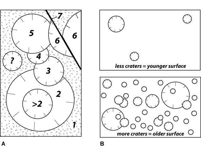
Overlapping rock units and impact craters, faults, etc. all can be used to determine the sequence of events in a map view. In Figure 8-12A, a lava flow surface is covered with impact craters. The craters must be younger than the lava flow. Where one crater overlaps or buries another, it must be younger than the other crater. The age of the crater marked with a "?" is unknown relative to the other crater, and all that can be said about the crater marked with a ">2" is that it is younger than crater 2.
Additionally, since these meteorite impact craters accumulate over time, the more impact craters a surface has, the older it is (i.e., higher crater density = older surface). Assuming a similar crater-forming rate, we can then estimate the relative age of various surfaces and features by counting the number of craters on them (Figure 8-12B)
Incendium Terra
Let's do a little exploring of the Earth's surface as it might have been during the early days of geologic time. Our early Earth destination is Incendium Terra (Figure 8-13), a mythical place representing Earth's surface as it might have been during the early days of geologic time. Let's try to understand the sequence of geologic events by looking at a map view (instead of a cross section)
|
|
|
|
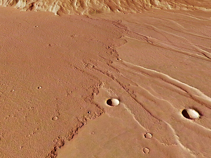
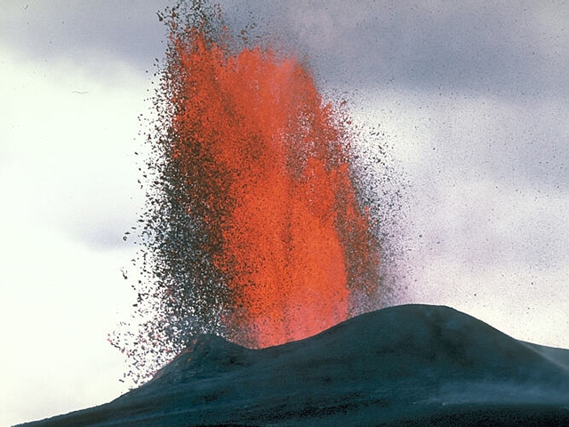
Figure 8-13. Eruption of the Incendium Terra map unit V |
|
|
|
|
Figure 8-14. The Incendium Terra sequence map diagram, representing a hypothetical portion of the Earth's surface during the Hadean Eon. Click HERE for a printable PDF version. |
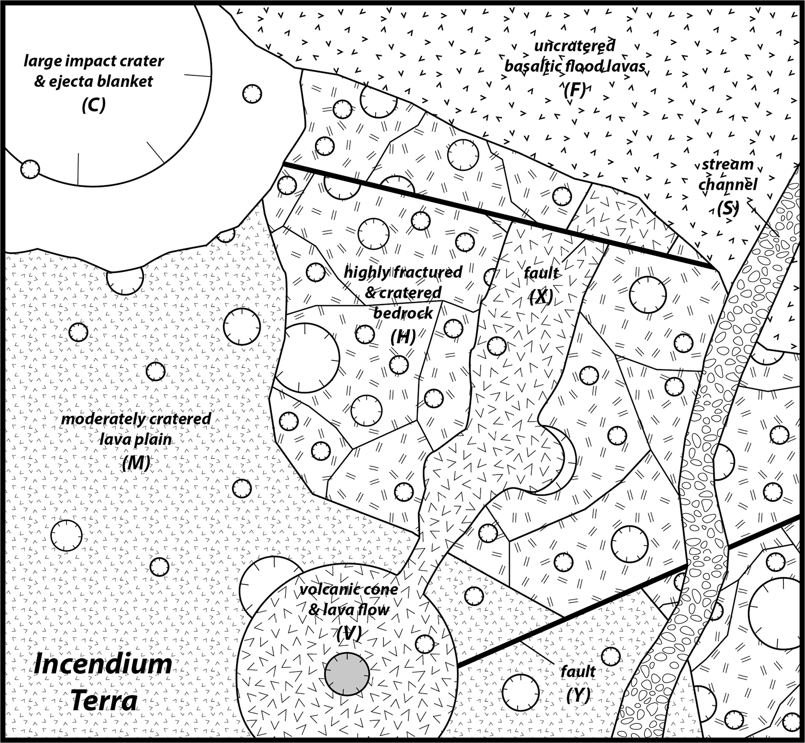
Quiz Me! questions D46 through D50 refer to the Incendium Terra sequence map diagram (Figure 8-14). Print a hard-copy of the diagram if necessary (see the link above for a printable PDF version). You can also refer to the Key to Map Fill Patterns (click HERE for a printable PDF version).
After finishing this lesson, complete the form below: